1
CLIMBER ACCESS TRAIL MAPPING
& GPS VISITOR TRACKING
IN INDIAN CREEK, UTAH
Kathryn DeSirant White
University of Utah, Department of Parks, Recreation, and Tourism
Natural Resource Recreation Planning & Management
Project Report
University of Utah
Matthew T.J. Brownlee, Ph.D.
University of Utah, Department of Parks, Recreation and Tourism
Nate Furman, Ph.D.
University of Utah, Department of Parks, Recreation, and Tourism
J. Adam Beeco, Ph.D.
Outdoor Recreation Planner, Federal Energy Regulatory Commission
Corresponding Author:
Matthew T.J. Brownlee, Ph.D., Chair
University of Utah
Department of Parks, Recreation and Tourism
1901 E. South Campus Drive Annex C, Rm 1085
Salt Lake City, UT 84112
matthew.brownlee@hsc.utah.edu
E XECUTIVE S UMMARY ProjectConclusions
·
ThesampledpopulationofclimbersinIndianCreekwasfoundtoberelativelyhomogenous
inperceivedskilllevel,experienceusehistory,specialization,anddemographics.
·
Sincetheparticipantswerefoundtobehomogeneous,findinga‘type’ofclimberwhomay
spendmoretimeatanyonelocationthroughoutthedaywasnotpossible.
·
Sincetheparticipantswerefoundtobehomogeneous,findinga‘type’ofclimberwhomay
becontributingmosttoinformaltrailswasnotpossible.
·
Itwasfoundthatmostparticipantswereconfusedatkeylocationsonroadsandtrails.
·
Inordertolessenconfusionaboutthelocationsofclimbingwallsandtrails,bothnarrative
andarrowsignageshouldbeplacedatkeylocationsthroughoutIndianCreektodirect
climbers.
A BSTRACT Corporationsfollowemployeedrivinghabits,biologiststrackwildlife,andparentsconfirmthe
locationofchildren.TheGlobalPositioningSystem(GPS)hasbecomesuchanintegralpartof
modernlifethatitisnosurprisethatresearcherscannowmonitorwhererecreationiststraveland
howmuchtimetheyspendatcertainlocations.InGPSVisitorTracking(GVT),adevicethatuses
GPSiscarriedbyaparticipantandrecordsthelocationoftheparticipantatregularintervals.
ResearcherscanthenuseGPSdatatoviewthetemporalandspatialdistributionofrecreationistsin
complexrecreationenvironments.
OnesuchcomplexrecreationenvironmentthathasincreasedinpopularityinrecentyearsisIndian
Creek,Utah.BecauseoftheperfectlyparallelverticalfissuresinWingatesandstonewalls,thisarea
hasbecomeaninternationalrockclimbingdestination.Rockclimbersaredrawntotheuniqueand
difficultclimbsaswellastheopenspaceandprimitivefeelingthatIndianCreekprovides.This
newfoundpopularityhasbroughthigherfrequenciesofclimbersalongwithnewmanagement
concerns,includinglanddegradation,impactstonaturalresources,andcrowdingatpopular
climbingareas.ThelandscapeofIndianCreekconsistsofvaststretchesofflatdesertcanyons
separatedbytoweringsandstonewalls.Thistopographicalcomplexitymakesthetaskofprotecting
naturalresourceswhilefacilitatingaccessdifficult.Consequently,themanagementgroupsofIndian
Creekarebeginningtorealizethatthisincreaseinpopularityisquicklycausingnaturalandsocial
impactsandthatgatheringinformationisanecessarysteptounderstandthefullscopeofthe
issues.
Thepurposeofthisstudywastoinformfuturelandmanagementdecisionsbyanalyzingcurrent
trailsystemsandcomparingrockclimbers’characteristicstotheirtemporalandspatialpatternsof
use.Theprimaryinvestigativequestionsforthisstudywere1)Dodifferenttypesofrockclimbers
travelindifferentways,2)Whichrockclimberscontributetoinformaltrails,and3)Spatially,how
doclimbersspendtheirtimeinIndianCreek?
Thisresearchwasimportantandnecessarybecauseitinformslandmanagementdecisionsfor
futuretrailmodificationsandimprovements,climbereducationprograms,andlandexchangesin
IndianCreek.ThisresearchcontributestofutureresearchbydevelopingGPStrackingmethods,
providesnewliteraturethatincorporatesgeography,recreation,andnaturalresource
management,andoffersafoundationforGPSuseinfutureinvestigationsforvariousrecreationand
leisureactivities.
Methods
Allstudyparticipantswereaskedtocompleteaquestionnairewithitemscapturingdemographics,
specialization,self-perceivedskilllevel,andpastusehistory.Toanalyzesocialdatafromthe
questionnaire,theresearcheruseddescriptivestatisticsafterstandarddatacleaningandensuring
adequatevalidationofthemeasurements.AK-meansclusteranalysiswasusedtoattempttodivide
climbersbasedontheirskilllevel,specialization,experienceusehistory,anddemographics.
Component1focusedonanalyzingclimbers’temporalandspatialpatternsofusebytracking
climbersfora24-hourperiod.Climberswereinterceptedattheircampsitesinordertoallowfor
thenaturaldispersionofparticipantstotheirdesiredclimbingarea.ToanalyzeGPSdatafrom
Component1,tracksfromeachparticipantwereclippedcomingtoandfromthecampground,to
andfromtheparkingareaneartheclimbingwall,andtoandfromtheclimbingwall.Thismethod
providedthetimesateachoftheselocationssothatthetotalamountoftimespentatcamp,driving,
atparkingareas,hikingtotheclimbingwall,andattheclimbingwallcouldbeaveragedand
comparedtothelengthofdaylighthoursaswellastheentire24-hourperiod.
Component2focusedonanalyzinginformaltrailuseatfiveclimbingwallsofinterest.Climbing
wallsofinterestareareaswithspecialmanagementconcernsincludinglanddegradation,resource
overuse,informaltrailproliferation,andcrowding.Thesefivewallswerechosenbasedonthe
highestuseareasfromComponent1.Theresearcherdefinedthe‘who’basedonthequestionnaire
responsestodegreeofspecialization,self-perceivedskilllevel,andpastusehistory.ToanalyzeGPS
datafromComponent2,onlyparticipanttracksthatincludedsectionsofinformaltrailsweretobe
comparedtothequestionnairedata.Studyparticipantsweretobesplitintofourgroupsbasedon
theamountoftimespentoninformaltrails,andanANOVAtestusingfourgroupswasgoingto
allowtheresearchertodeterminewho(demographicallyandrecreationcharacterizations)
contributesmosttoinformaltrails.Theresults,however,didnotallowthisanalysis.
Results
Thestudypopulationwasfoundtoberelativelyhomogeneousindemographics,specialization,selfperceivedskilllevel,andpastusehistory.Therefore,findinga‘type’ofclimberwhocontributes
mosttoinformaltrailproliferationorspendsthemosttimehikingwasnotpossible.InComponent
1,itwasfoundthatmostclimbersspendthemajorityoftheirdaylighthoursattheclimbingwalls
andtheyspendmoretimedrivingthanhiking.OriginallyinComponent2,aseriesofK-Means
ClusterandANOVAtestswereperformedtocomparegroupsofclimberswhospentdiffering
amountsoftimeoninformaltrails;however,thehomogeneousresultsdidnotallowtheresearcher
todivideparticipantsintogroups.Therefore,Component2stillfocusedonanalyzinginformaltrail
useatthefivemostusedclimbingwalls,andrecommendationsweremakeforsignagebasedonthe
GPSVisitorTracking.
Conclusion
Studies,suchasthisone,thatexamine,assess,andmonitorrecreationists’impactstoprotected
naturalareasandtheirrelationshipstoinfluentialfactorscanhelpidentifyandevaluateresource
impacts,facilitatetheunderstandingofcausesandeffects,andprovideinsightintotheprevention,
mitigation,andmanagementofproblems(Marion,1998;Leung&Marion,2000).Sincespatialand
temporaldistributionsofusecontributetotheextentofrecreation-relatedresourceimpacts
(HammittandCole,1998),informationgleanedfromGPSVisitorTrackinginIndianCreek,Utah
providesthemanagementofIndianCreekandothernaturalareaswithclimberdistributionat
climbingareasaswellasinsightintothecausesofnaturalresourceimpacts. TABLEOFCONTENTS
1 CHAPTER1:INTRODUCTION ....................................................................1
1.1
Purpose,Objectives,&PrimaryInvestigativeQuestions..........................................................................2
1.2
TheProblem.....................................................................................................................................................................3
1.3
BLM’sTrailManagementSystem..........................................................................................................................4
1.4
Rationale............................................................................................................................................................................5
1.5
KeyComponents............................................................................................................................................................6
2 CHAPTER2:SYNTHESISOFLITERATURE...............................................7
2.1
Trails....................................................................................................................................................................................7
2.2
InformalTrails................................................................................................................................................................7
2.3
MotivationsbehindInformalTrailDevelopment.........................................................................................8
2.4
SpatialAnalysisofInformalTrails........................................................................................................................9
2.5
ImplicationsforLandManagers.........................................................................................................................10
3 CHAPTER3:METHODS...........................................................................11
3.1
DataCollection.............................................................................................................................................................13
3.2
InteractionwithStudyParticipants..................................................................................................................13
3.2.1
InterceptLocations.........................................................................................................................................13
3.2.2
InterceptScript..................................................................................................................................................14
3.2.3
ContactForm......................................................................................................................................................14
3.2.4
VisitorQuestionnaire.....................................................................................................................................15
3.2.5
CollectingDataLoggers.................................................................................................................................16
3.3
CleaningData................................................................................................................................................................17
3.3.1
CleaningSocialData........................................................................................................................................17
3.3.2
CleaningGPSData............................................................................................................................................17
3.3.3
CleaningGPSDatainIndianCreek..........................................................................................................19
3.4
DataAnalysis................................................................................................................................................................19
3.4.1
QuestionnaireAnalysis.................................................................................................................................19
3.4.2
Component1:Time-UseStudy..................................................................................................................20
3.4.3
Component2:InformalTrailUse............................................................................................................20
3.5
PilotStudies...................................................................................................................................................................21
3.5.1
3.5.2
GPSTrackerTesting........................................................................................................................................21
Time-UseStudyofRockclimbersinIndianCreek..........................................................................29
4 OUTCOMES.................................................................................................32
4.1
ResponseRate&Sampling....................................................................................................................................32
4.2
QuestionnaireResults..............................................................................................................................................32
4.2.1
4.2.2
4.2.3
Demographics....................................................................................................................................................32
PastUseHistory................................................................................................................................................36
Specialization.....................................................................................................................................................38
4.2.4
Self-ReportedSkillLevel..............................................................................................................................40
4.3
GPSVisitorTrackingResultsandDiscussion..............................................................................................42
4.3.1
Component1:Time-UseStudyResults&Discussion...................................................................42
4.3.2
Component2:InformalTrailUseResults&Discussion..............................................................43
4.4
TrailMappingResults..............................................................................................................................................44
4.5
ParticipantTrailUse.................................................................................................................................................46
4.6
SignageRecommendationsfortheMostVisitedClimbingAreas......................................................47
4.7
InterpretationofGPSVisitorTracking............................................................................................................49
4.8
RecommendationsforFutureResearch.........................................................................................................51
4.9
Implications...................................................................................................................................................................52
5 REFERENCES:............................................................................................53
AppendixA–Manual:GPSTrackingofRockClimbersinIndianCreek,Utah
AppendixB–Map:IndianCreekClimbingWalls&Trails
AppendixC–Map:GPSVisitorTracking
AppendixD–Map:SignageRecommendations
AppendixE–Maps&RecommendationsforTop5VisitedClimbingAreas
AppendixF–IndianCreekClimbingTrailQualityandAccess
1 CHAPTER1:INTRODUCTION IndianCreekCorridorislocated15milesnorthofMonticello,UtahalongHighway211,whichleads
totheNeedlesDistrictofCanyonlandsNationalPark.Thiscorridorcontainsarchaeologicaland
culturalresourcessuchasthepetroglyphsatNewspaperRockandrecreationopportunitiessuchas
hikingandrockclimbing.TheBureauofLandManagement(BLM)managesthemajorityofthis26
milesectionasaSpecialRecreationManagementArea(SRMA),butthisareaalsoconsistsofland
thatisstateandprivatelyowned.TheBLMissuespermitsforcattlegrazingandrecreationguiding
andalsocaresforseveralfacilitiesinIndianCreekSRMAincludingroadways,threecampingareas,
andfiveareaswithpittoilets.ThemainprivatelandowneristheNatureConservancy,whichin
1997boughttheDugoutRanch,whereHeidiReddhasruntheIndianCreekCattleCompanyfor
overfortyyears.Heidiwasgivenalifeleaseof25acressotheranchcontinuestooperate.The
NatureConservancymanagesthislandtofulfillthreestewardshipgoals:1)topreservethe
property’secologicalandopenspacefeatures,2)tousethepropertyasaresourceforecological
researchandnaturalhistoryinterpretation,and3)tocontinueahistoricranchingoperationwith
theleastimpact.TheIndianCreekCattleCompanyholdsgrazingpermitsthroughmuchofIndian
CreekSRMAonBLMland.
BecauseoftheverticalfissuresintheWingatesandstonewallsthatlinethiscorridor,IndianCreek
hasbecomeaninternationalrockclimbingdestinationinrecentyears.Rockclimbersaredrawnto
theuniqueanddifficultclimbsbutalsotheprimitiveWildWest.Thenewfoundpopularityhas
broughthigherfrequenciesofrockclimbersalongwithnewmanagementconcerns,includingland
degradation,impactstonaturalresources,andcrowdingatpopularclimbingroutes.Asinterestin
rockclimbinggrows,landmanagersofpopularrockclimbingareasarefacedwiththecomplicated
taskofprotectingnaturalresourceswhilefacilitatingaccess.Sincethelandiscomplexwithvast
stretchesofflatdesertcanyonsseparatedbytoweringsandstonewalls,thetopographical
complexitymakesthetaskofmanagingrockclimbersdifficult.AnoverviewofIndianCreekandthe
climbingareascanbeseeninFigure1.
1
Figure1a:MapofIndianCreek,Utah(FriendsofIndianCreek,2014).
1.1
PURPOSE,OBJECTIVES,&PRIMARYINVESTIGATIVEQUESTIONS
Thepurposeofthisstudywastoinformfuturelandmanagementdecisionsbyanalyzingcurrent
trailsystemsandcomparingrockclimbercharacteristicstotheirtemporalandspatialpatternsof
use.
Theprojectobjectivesincluded:
1. ToprovidetheBLMwithGPSdatafromclimberaccesstrailsinIndianCreek
2. Todevelopamapofrecreationresourcesandaccesstrails
3. Toidentifythetemporalandspatialdistributionofrockclimbers
4. Toidentifyinformaltrailsatfiveclimbingareasandcharacterizethetypeofrockclimbers
thatmaybecontributingtothesetrails
2
Theprimaryinvestigativequestionsforthisstudywere:
1. Dodifferentrockclimbertypestravelindifferentways?
2. Whichrockclimberscontributetoinformaltrails?
3. Spatially,howdoclimbersspendtheirtimeinIndianCreek?
Inordertoaddresstheresearchpurpose,objectives,andprimaryinvestigativequestions,this
researchinvolvedseveralmethods.First,theresearcherusedGPStomapoverfiftyformaland
informalaccesstrailstoclimbingwallsinordertoinventorycurrentformalandinformaltrail
locations.ThisstepsatisfiedtheobjectivesofprovidingtheBLMwithGPSdatafromclimberaccess
trailsandsuppliedthenecessarydatatocreateamapofrecreationresources.Second,the
researcherperformedatwo-componentclimberusestudybycouplingGPStrackingofparticipants
withaquestionnaire.Thefirststudycomponentfocusedonanalyzingthetemporalandspatial
patternsofusebytrackingclimbersfora24-hourperiod.Thiscomponentprovidedtheresearcher
withtemporalandspatialdistributiondatatoanswerthequestionofwhererockclimbersspend
theirtimeinIndianCreek.Thesecondstudycomponentfocusedonanalyzinginformaltrailuseat
fiveclimbingwallsofinterest.Thiscomponentallowedtheresearchertocomparetraillocations
andquestionnairedataandprovidedinsighttothequestions‘Whichrockclimberscontributesto
informaltrails?’and‘Dodifferentrockclimbertypestravelindifferentways?’.
1.2
THEPROBLEM
Althoughoutdoorrecreationisoftenconsideredtobenonconsumptiveuse,overtimeitinevitably
alterstheenvironment(Cole,2004).Sincethehumanandnaturalworldsaredeeplyintertwined,
integratingsocialandecologicalresearchisnecessaryforabetterunderstandingofrecreation
impacts.Thisresearchfallsintothecategoryofrecreationecology,whichaimstounderstand,
examine,assess,andmonitorrecreationistimpacts(Marion,1998).Thisknowledgecanhelp
identifyandevaluateresourceimpacts,facilitatetheunderstandingofcausesandeffects,and
provideinsightintotheprevention,mitigation,andmanagementofproblems(LeungandMarion,
2000).
Currently,theMonticelloFieldOfficeoftheBureauofLandManagement(MonticelloBLM)is
realizingthepopularityofthisareatotherockclimbingcommunity.TheMonticelloBLMisalso
realizinghowthisnewfoundpopularityisquicklycausingvariousimpacts,naturalandsocial,and
thatgatheringinformationisanecessarysteptounderstandthefullscopeoftheissues.
ThisresearchprovidestheBLMwithasolidbaseofinformationonrockclimbertime-useand
potentialareasofoveruse.Withsevereoveruse,historical,cultural,andnaturalresourcesbecome
3
threatened,whichcanleadtodirectmanagementstrategies.Thesetypesofmanagementstrategies
canleadtorecreationistdissatisfaction.Byinformingmanagementdecisionswithvaluabledata
suchasaccuraterecreationisttime-useinformation,managementcanmakeappropriatedecisions
whileallowingforcontinuedaccessandsenseoffreedomforrecreationists.
Studies,suchasthisone,thatexamine,assess,andmonitorrecreationistimpactstoprotected
naturalareasandtheirrelationshipstoinfluentialfactorscanhelpidentifyandevaluateresource
impacts,facilitatetheunderstandingofcausesandeffects,andprovideinsightintotheprevention,
mitigation,andmanagementofproblems(Marion,1998;Leung&Marion,2000).Sincespatialand
temporaldistributionsofusecontributetotheextentofrecreation-relatedresourceimpacts
(HammittandCole,1998),informationgleanedfromGPStrackingrockclimbersinIndianCreek,
UtahwillprovidemanagementofIndianCreekandothernaturalareaswithtypicalclimber
distributionatclimbingareasaswellasinsightintothecausesofnaturalresourceimpacts.
Sincetraditionalmethodsofcollectingspatialandtemporaldatacanbeinaccurateand
burdensometoboththeresearcherandtheparticipant,GPStrackingofrecreationistsprovides
moreprecise,accurate,andreliabledatathatisnotaslaborintensiveastraditionalmethods(Hallo
etal,2012).InGPSvisitortracking(GVT),adevicethatusestheGlobalPositioningSystemis
carriedbyastudyparticipantinordertorecordthelocationoftheparticipantatregularintervals.
GVThasbeenaprovenmethodforunderstandingthetemporalandspatialdistributionof
recreationistsincomplexrecreationenvironments.
1.3
BLM’STRAILMANAGEMENTSYSTEM
IntheNationalTrailsSystemActof1968,Section3(a),Congressdesignatedthreeclassificationsof
trailsforpublicuse–1)NationalHistoricTrails,2)NationalScenicTrails,and3)National
RecreationTrails.TheBureauofLandManagement(BLM)managesover6,000milesofpublicuse
trailsthatareclassifiedwithintheNationalTrailsSystem(BLM,2009).However,themajorityof
trailsonBLMlanddonotfallintotheNationalTrailsSystemActsdesignations.Morethan16,000
milesofmultipleusetrailsaredistributedoverapproximately258millionacresofBLMland.The
BLMmanagestrailsinaccordancewiththeBLMLandUsePlanningHandbookaswellasotherBLM
DirectivesSystemsdocuments.EachFieldOfficealsohasitsowngoalsandobjectivesformanaging
theirlandintheircurrentResourceManagementPlan(RMP).Twointernaldatabasesareusedas
managementtoolsfortheextensiveBLMtrailsystem–theFacilitiesAssetsManagementSystem
(FAMS)andtheRecreationManagementInformationSystem(RMIS).
4
SincemanytrailsinIndianCreekhavenotbeenaccuratelyrecordedandincludedinthese
databases,theresearcherrecordedaccurateGPSreadingsonthelocationofclimbers’trailsin
ordertoprovideafoundationforthefuturemanagementofIndianCreek.
1.4
RATIONALE
Inanyresearch,theresearchernotonlywantsthereadertounderstandwhatheplanstodo,but
alsowhytheresearchisbeingdoneatall(Maxwell,2012).Therationaleofastudyismeantto
convincetheaudiencethatthestudyisworthdoing(Sirakaya-Turk,2011).Arationalemustbe
meaningful,well-developed,defensible,clear,andaccurateinordertobeconvincingtoreaders
(Alasuutarietal,2008).Therationaleforthesignificanceofastudycanbeachievedif1)itwillfilla
gapinthebodyofknowledgeandliterature,2)itwillansweranunansweredquestionorsolvea
problemthathasnotbeensolved,and/or3)theoutcomeofthestudywillresultinafindingthatis
importanttothefield(Sirakaya-Turk,2011).
ThisresearchprovidesthemanagementofIndianCreekwithanunderstandingofthetemporaland
spatialdistributionofclimbers,mapsofthelocationsofclimberaccesstrailsandseveralinformal
trails,andinsightintotypesofclimberswhomaybecontributingtoinformaltrails.Withthe
fragilityofthedesertlandscapeandincreasinginterestfromrockclimbers,IndianCreekisfacing
thepressuresofoveruse,includinglanddegradation,impactstonaturalresources,andcrowding.
ThisresearchprovidesmanagersofIndianCreekwithstrategiestohelppreventlanddegradation
andimpactstonaturalresourceswhilemaintainingaccesstoanareathatisbelovedbyclimbers.
Thisresearchisimportantandnecessarybecauseitinformslandmanagementdecisionsforfuture
trailmodificationsandimprovements,rockclimbereducationprograms,andlandexchangesinIndian
Creek,whileprovidingvaluableinformationforotherrecreationareasaswell.
ThisresearchcontributestofutureresearchbydevelopingGPStrackingmethods,providesnew
literaturethatincorporatesgeography,recreation,andnaturalresourcemanagement,andoffersa
foundationforGPSuseinfutureinvestigationsforvariousrecreationandleisureactivities.While
researchershaveperformedGPStrackingonrecreationistsinthepast(Halloetal,2012;D’Antonio
etal,2010;Laietal,2007),fewhavecoupledGPSdatawithsocialdatafromquestionnaires.
PerformingGPStrackingandcollectingquestionnairedataatthesametimeallowsforbetter
understandingofspatialdistribution,useintensity,andtravelpatternsinrelationtorecreationist
characteristicslikemotivations,desires,andabilitylevel(Beeco&Brown,2013).Sincethehuman
andnaturalworldsaredeeplyintertwined,integratingsocialandecologicalresearchisnecessary
forabetterunderstandingofrecreationimpacts.
5
Leisureandrecreationareimportanttooursocietyforavarietyofreasonsincludingphysicaland
mentalhealth,satisfactionwithlife,socialinteraction,andfamilycohesiveness(vanBaaketal,
2003;Edingtonetal,1995;Crandall,1979;West&Merriam,2009).Inrecentyears,rockclimbing
hasonlyincreasedinpopularitybothasarecreationactivityandasacompetitivesport(Sheel,
2004).Althoughoutdoorrecreationisoftenconsideredtobenonconsumptiveuse,overtimeit
inevitablyalterstheenvironment(Cole,2004).Becauseofthepopularityofrockclimbing,places
likeIndianCreekarebecomingimpactedinvariousways,includinglanddegradation,impactsto
naturalresources,andcrowding.Byprovidinginformationonrockclimbercharacteristics,
informaltrailuse,andtime-useatIndianCreek,thisresearchhopestocontributetocontinued
accessforrockclimbersandotherrecreationistswhilemaintaininganacceptableimpacttonatural
resourcesinmanyclimbingandrecreationareas.
1.5
KEYCOMPONENTS
AsseeninTable1,theresearcherusedGPS,GIS,GPSVisitorTracking,andaquestionnaireto
addresstheprojectgoalsandobjectives.
Table1a:KeyComponentsofthestudy
Component
Importance
Inthepast,collectingtemporalandspatialdatainvolvedhavingparticipantsdraw
theirpathsandrecordtimesonblankmaps,whichistime-consumingand
generallyunwelcomedbyrecreationists.SinceGlobalPositioningSystem(GPS)
GPS
datacollectionhasbecomeaccessible,thetaskofmonitoringspatialandtemporal
useiseasierforthestudyparticipantandtheresearcherandcanallowformore
accuratedatacollection.
GeographicInformationSystems(GIS)assistedwithdataanalysis,mapcreation,
GIS
andtime-useanalysis.
SmallGPSdataloggerswereusedto‘track’rockclimbersduringtheirdaily
GPSVisitor
activitiesinIndianCreek.Thistechnologyallowedforanaccurateviewofthe
Tracking
temporalandspatialuseofthestudyarea.
MoststudiesthathaveusedGPStrackingofrecreationistshavefocusedon
monitoringthespatialandtemporaldistributions(Halloetal,2012;D’Antonioet
al,2010;Meijlesetal,2013).ThesestudiesprovethatGPSunitsarecapableof
Questionnaires providingtheinformationnecessaryinunderstandinghowsocialtrailsdevelop.
MergingGPStrackingalongwithquestionnairesandsocialconstructdatainthis
studyallowedforadeeperknowledgeofhowsocialtrailsdevelop,whattypesof
rockclimberscontributetosocialtrails,andwheresocialtrailsarelikelytoform.
6
2 CHAPTER2:SYNTHESISOF LITERATURE
2.1
TRAILS
Atrailisapathortrackthroughroughcountry,suchasforest,thatismadeofadirtorstonesurface
forthepassageofpeopleoranimals.Trailsaretheforemostsystemforrecreationiststoaccess
desirablelocations.Paststudieshaveshownthatonlyabout15to20percentofrecreationists
travelofftrailsinmostareas,andiftheydotravelofftrail,thesedistancesareusuallyminimal
(Lucas,1978).Trailsareusedbypeopleasameanstotravelfromonelocationtoanother.In
recreation,trailsallowrecreationistsaccesstonodes,whicharedestinationareasorlocationsof
interest(Hammitt&Cole,1998).Nodescouldincludecampsites,ascenicoverlook,orawater
source.Recreationistsdependontrailsystemsforsafetyanddirection.Thisdependencecanbea
powerfultoolfordirectingusepatternsandeveninfluencingtheexperiencesoftherecreationists
(Hendeeetal,1978).
Recreationistsvarybyactivity,and,therefore,differentrecreationistgroupshavevaryingreasons
forusingtrails(Manning,2011).Theprimarygoalofbackpackingistohikeforalongdistancein
ordertogettoalocationofinterest.Thebackpackerthencampsinthatlocationofinterestand
continuesonthetrailthefollowingday.Theprimarygoalofmountainbikingistorideabikeon
trails.Thegoalcouldpossiblybetogettoasceniclocation,butridingonthetrailmaybethe
primaryobjectiveaswell.Forthesetworecreationistgroups,thetrailisadrivingfactorofthe
recreationexperience.Ontheotherhand,theprimarygoalforrecreationistsistoclimbrocks.
Whilethetrailisusedtogetfromthecarorthecampsitetotherock,theintegrityofthetrailisnot
thereasontorecreateandisnotthebiggestpartoftherecreationexperience.
2.2
INFORMALTRAILS
Manylowimpactphilosophieshavebecomecommonplaceinthevocabularyofrecreationists:
LeaveNoTrace,minimumimpacts,leaveonlyfootprints,takeonlyphotographs.Thisverbiage
signifiesthatindividualsandgroupsarecapableofavoidingorminimizingimpactstonaturalareas
withtheproperequipmentandknowledge(Pigram,1983).
Informalorsocialtrailsaretrailsthatexistthatwerenotplanned,createdby,orofficially
recognizedbythelandmanagers.Informaltrailscanoccurasjustonetrailsegmentorcanbe
multiplelinked.Inareasofhighuse,theycanoftenbemadeupofhundredsofintertwinedtrails
thatcreateawebofsociallyusedpaths.Informaltrailsareoftencreatednearalreadymanaged
trails,inmeadows,inmuddystretchesoftrail,andonswitchbacktocreateamoredirectroute
7
(Coleetal,1987).Thesetypesoftrailscanalsooccurnearnodessuchascampsites,viewpoints,and
watersources(Buckley,2004).Thesetrailsinevitablycauseharmtothenaturalenvironment.
Evenwellplannedtrailscancauseimpactssuchassoilcompactionandvegetationlossandcan
fragmenthabitatanddisruptwildlifemovementtothenaturalenvironment,butforinformaltrail
development,theseimpactsareamplified(Pickering&Growcock,2009).Informaltrailsdissect
largelandscapesintosmallersections,whichcanresultinalteredhydrologyandsoilmoisture,
reducedhabitat,andtheinvasionofinvasivespeciesusinginformaltrailsaschannelsfortraveland
dispersion(Forman,1995).Informaltrailscanalsocreatebarriersforcertainspecies,which
reducestheabilityofanimalstodisperseseedsandreducestherateofanimalmovementonthe
ground(Holmquist,2004).TheseverenatureofinformaltrailimpactswerebroughttotheU.S.
NationalParkService’sattentionwhentheVERPmanagementframeworkselectedtheproliferation
ofinformaltrailsasinimpactindicatorduetotheapparentecologicalandsocialsignificance(NPS,
2004).
2.3
MOTIVATIONSBEHINDINFORMALTRAILDEVELOPMENT
Inordertobeginunderstandingthemotivationsbehindinformaltraildevelopment,itisimportant
tounderstandmotivationstorecreate.Maslow(1954)theorizedthateveryonepossessesonlyfive
basicneeds:physiologicalneeds,safety/securityneeds,belongingness/loveneeds,andselfactualizationneeds.Thistheorywassimplytheneedsthatpertainedtoallaspectsoflife,butitis
importantinunderstandingdeeperrecreationmotivations.Whilemanywordscanbeusedto
describewhypeoplearedriventorecreate,motivationsforleisureandrecreationcanbepared
downtoincludethefollowing1)escape,2)enhancingrelationships,3)personalmastery,and4)
winning(Dillard&Bates,2011).Neulinger(1974)hypothesizedthatleisurehadtwodimensions:
1)perceivedfreedom(i.e.theactivityhadtobeundertakenfreely,withoutconstraintor
compulsion)and2)intrinsicmotivation,theconceptthatsatisfactionarisesfromengaginginthe
leisureactivityitselfinsteadofhavinganexternalreward.Thesenaturalmotivationsgivehumans
reasonandincentivetodosomethingorbehaveacertainway.
Recreationistscanalsobeplacedintothecategoriesof‘casual’and‘serious’intermsoftheirleisure
choices.Seriousrecreationcaptivatesitsparticipantswithcomplexitiesandchallenges,while
casualrecreationrequireslittleornotraining.Rockclimbingisconsideredaserious,highrisk,
extremesport(Selfetal,2007).Studiesthathaveresearchedmotivationinhighrisksportshave
foundthatthesepeopletendtohavehighself-efficacy,highrisktakingbehaviors,andadesirefor
8
mastery.Theyalsohavetheabilitytoinhibittheinfluencesofanxiety,fear,andtherecognitionof
danger(Slanger&Rudestam,1997).
Whiletheremaybeanawarenessofthedamagesthatinformaltrailscandotoournatural
resources,theproliferationofinformaltrailsappearstoonlycontinue.Sowhydopeoplemake
socialtrailsandwhataretheprimarydriversfordoingso?Socialtrailsbeginwithjustoneperson
leavingthemaintrailinordertoaccomplishsomething.Thiscanbetofindsolitude,findfirewood,
getsomewherefasterthanthecurrenttrail,orgosomewherethatatraildoesnotalreadygo.Once
onepersonleavestheexistingtrailsystem,thegrassiscompressedorthedirtisscuffledwhichcan
triggerthenextpersonwhousesthetrailtoquestionwhetherornottousethesamenewer
informaltrail(Manning,2011).
Sincethetrailisnotthemainsourceofrecreationforrecreationists,itispossiblethatlessthought
goesintothejourneytotheclimbthanthejourneyitself.Atrailissimplyameanstoanendfora
rockclimber,sotheimportanceofthetrailintegrityandstructuredoesnotmatterasmuchasthe
importanceofaclimb.Manytrailstoclimbingareasarecategorizedas‘climbers’trails.’Whenrock
climbingstartedbecomingpopular,mostclimbers’trailswereinformaltrailsthatweredeveloped
overtimebyclimbershikingstraightupahillsidetotherockwall.Sincethemotivationbehind
recreationistsistoclimb,makingtheapproachhiketheshortestamountoftimeanddistance
allowsformoretimespentclimbing.Sincetrailsthatoccuronthefalllineofahillsideare
susceptibletoerosion,mostclimbers’trailsarenotdesirableandareinneedofmanagementand
addedswitchbacks.Thestrongpersonalitytraitsandmotivationsofclimberscouldalsocontribute
toinformaltrailproliferation(Kerr,2014).Sincetheendgoalistoclimb,thedistractionofseeinga
rockwallbutnotquicklyandeasilyseeingaformaltrailcouldforcearecreationisttoforgehisown
path.
2.4 SPATIALANALYSISOFINFORMALTRAILS
Sinceinformaltrailsareoftenwidespreadthroughoutalandscapeandarequitevariablein
structure,thedevelopmentofmonitoringprotocolsforinformaltrailsandtheirassociated
indicatorshasbeendifficult(Manning,2011).Theextensivenatureofthesetrailsystemshasmade
assessingandmonitoringinefficient(Marionandothers,2006).Spatially,thesetrailscanwidely
differintheamountofspacetheytakeup–somecoveralargeamountofspacewithinafacilityand
areobviouswhileothersaresmallandmaybedifficulttospot.Thesedifferencesininformaltrails
havemadethemdifficulttomonitorandcreatesolutionsformanagementstrategiesthatfitacross
theboard.Overtheyears,informaltrailshavebeenmonitoredusingoneofthreegeneral
9
approaches–estimates,extensivefieldinventories,ortheextractionofgeoreferencedimagerylike
satelliteimagery.
Traditionalmethodsofcollectingspatialdistributionsofusehaverequiredstudyparticipantsto
tracktheirtravelroutesonblankmapsandrecordthetimespentatcertainlocations(Halloetal,
2012).Thistypeofdatacollectiononlybecomesunreasonableandcomplexwhenstudying
recreationistsincomplextrailssystemsorwhentrailsareunmarked.Sincethesetraditional
methodsofcollectingspatialandtemporaldatacanbeinaccurateandburdensometoboththe
researcherandtheparticipant,GPStrackingofrecreationistsprovidesmoreprecise,accurate,and
reliabledataandisnotaslaborintensive(Halloetal,2012).InGPStracking,adevicethatusesthe
GlobalPositioningSystemiscarriedbyastudyparticipantinordertorecordthelocationofthe
participantatregularintervals.
2.5
IMPLICATIONSFORLANDMANAGERS
Sincestudieshavedemonstratedtheneedfordatacompilationovertimeonecologicalhealth
effectsofinformaltrailproliferation(Leungetal,2011),managersshouldnotehowimportantitis
tostartcollectingspatialdatafromrecreationistsandcontinuetocollectthisdata.Abetterviewof
themanagementarea’sneedsorproblemareascanbeseenwhenlookingatspatialdistributionsof
recreationistsovertime.Creatingwellthoughtoutinformationandeducationtechniques
specificallytargetingthemanagementarea’srecreationistgroupscanassisttheon-the-ground
effortininformingrecreationistsabouttheissuesrelatedtoinformaltrails.Creatingschool
educationprogramsisanotherprovenwaytoeducateearlyandpreventinformaltrailcreationin
thefirstplace(Browningetal,2012).
Themostimportantimplicationforlandmanagersistounderstandthetypesofrecreationists
spendingtimeintheirmanagementzone.Oftentimes,themotivationsofrecreationistgroupsare
variedbytherecreationsport,age,orgender(Afthinosetal,2005;Whiteetal,1991).By
recognizingwhatspecificrecreationistgroupsareusinganarea,managerscanbegintounderstand
whattherecreationistsaremotivatedbyandeventuallywhytherecreationistsmaybecreating
informaltrailsystems.Sincemanyinformaltrailsaredevelopedbecauseaneedisnotbeingtaken
careof,managementmustallowforanopenlineofcommunicationandon-the-groundvisibilityto
theirrecreationists.Whenlandmanagersunderstandhowandwhyinformaltrailsdevelop,they
areabletoconsiderforfuturetrailconstructionormodificationsandimprovementsofexisting
trails.
10
3 CHAPTER3:METHODS Thisresearchaimedtoanswerthreeprimaryinvestigativequestions:1)Dodifferentrockclimber
typestravelindifferentways,2)Whichrockclimberscontributetoinformaltrails,and3)Spatially,
howdorockclimbersspendtheirtimeinIndianCreek?GPSdatacollectioninthisstudyhad
severalcomponentsinordertoaddresstheseprimaryinvestigativequestions:
Initially,theresearcherhikedandtookGPSreadingsfromthemajorityoftheclimberaccesstrails
withaTrimbleJuno.GPSreadingsforthecurrentrecreationfacilities(toilets,parkinglots,
campgrounds)werealsotaken.Thisstepprovideddataofthecurrentresourcesavailabletorock
climbersinIndianCreek.
Component1focusedonanalyzingtemporalandspatialpatternsofusebytrackingrockclimbers
fora24-hourperiod.Climberswereinterceptedattheircampsiteinordertoallowforthenatural
dispersionofparticipantstotheirdesiredclimbingarea.
Component2focusedonanalyzinginformaltrailuseatfiveclimbingwallsofinterest.Climbing
wallsofinterestareareaswithspecialmanagementconcernsincludinglanddegradation,resource
overuse,informaltrailproliferation,andcrowding. Originally, climbersweretobeinterceptedat
thetrailheadorparkinglotofeachclimbingwallofinterestinordertofocusontravelpatternsat
thatparticularclimbingwall;however,sincetheBLMdidnothaveastrongsenseofthemost
popularclimbingareas,theGVTdatafromComponent1wasusedtofindthefivemostpopular
climbingareas.Theresearcherdefinedthe‘who’intheresearchquestionsbasedonthe
questionnaireresponsestodegreeofspecialization,self-perceivedskilllevel,andpastusehistory.
Allstudyparticipantswerealsoaskedtocompleteaquestionnairewithitemscapturing
demographics,specialization,self-perceivedskilllevel,andpastusehistory.
11
Table3a:Studycomponentsandapplicableinstrumentsandareasofuse
Component
GPSMappingof
InformalTrails
GPSVisitor
Trackingfor
InformalTrails
Analysis
GPSVisitor
Trackingfor
Time-use
Analysis
Questionnaire
GPSMappingof
ClimberTrails
Instrument
FocusAreaorInterceptLocation
TrimbleJuno
FivesitesdeterminedbyGVTmostpopularareas
Canmore
FivesitesdeterminedbyGVTmostpopularareas
·
·
Canmore
·
·
·
·
·
Paper
·
Questionnaire
·
·
·
·
·
·
·
·
·
·
·
·
·
TrimbleJuno ·
·
·
·
·
·
·
·
·
·
·
·
CreekPastureCampground
SuperbowlCampground
BridgerJackCampground
CottonwoodCreekCampArea
PrimitiveCampingAreas
CreekPastureCampground
SuperbowlCampground
BridgerJackCampground
CottonwoodCreekCampArea
PrimitiveCampingAreas
1stMeatWall
·
2ndMeatWall
·
4x4Wall
·
BattleoftheBulgeButtress ·
BioturbationWall
·
BlueGrammaCliff
·
TheBridgerJacks
·
BrokenTooth
·
CatWall
·
ChurchRock
·
CliffsofInsanity
·
Critic’sChoice
·
DisappointmentCliffs
·
DonnellyCanyon
·
ElectionWall
·
FinWall
·
ForgottenTower
·
FrictionSlab
·
FringeWalls
·
·
TheGash
TheHappySubmarine
·
LavenderButte
·
LeftRambo
·
12
NorthSixShooterPeak
TheOptimator
TheOriginalMeatWall
PetrifiedHornetWall
PistolWhipped
PowerWall
PublicServiceWall
ReservoirWall
SabbaticalWall
Scarface
SelfishWall
ShockandAwe
SinbadWall
SixStarWall
SlugWall
SouthSixShooterPeak
SparksWall
Suburbia
SupercrackButtress
TechnicolorWall
VitaminDWall
TheWall
WayRambo
3.1
DATACOLLECTION
PleaseseetheManualofGPSTrackingRockClimbersinIndianCreek,UtahinAppendixAfor
specificinformationontheGPStracker’sinitialset-up,uploading,anddatamanipulation.
3.2
INTERACTIONWITHSTUDYPARTICIPANTS
3.2.1 INTERCEPT LOCATIONS
Thefirststudycomponentfocusedonanalyzingtemporalandspatialpatternsofusebytracking
climbersfora24-hourperiod.Thiscomponentprovidedtheresearcherwithtemporalandspatial
distributiondatatoanswerthequestionofwhereclimbersspendtheirtimeinIndianCreek.For
Component1,thefourmaininterceptlocations:CreekPastureCampground,BridgerJack
Campground,SuperBowlcampingarea,andthecampingareaalongCottonwoodCreekonBeef
BasinRoad.Theseareascanbeseenbelow:
Figure3a:Interceptlocations
13
Thesecondstudycomponentfocusedonanalyzinginformaltrailuseatfiveclimbingwallsof
interest.Thiscomponentallowedtheresearchertocomparetraillocationsandquestionnairedata
inordertocharacterizethetypeofclimberthatmaybecontributingtoinformaltrailsaswellas
provideanswerstothequestions‘Whichrockclimberscontributetoinformaltrails?’and‘Do
differentrockclimbertypestravelindifferentways?’.Interceptlocationswerethesameas
Component1.
3.2.2 INTERCEPT SCRIPT
Participantswereapproachedattheircampsite.Theywereinformedaboutthestudy’spurposeand
objectivesandexpectationsasparticipants.
Hi,mynameis_____________.I’mfromtheUniversityofUtah.Iamconductingastudyofthespatial
distributionofclimbersinIndianCreek.IamaskingthatyoucarrythissmallGPSunitwithyouforthe
next24-hours(Component1)/foryourtimeatthisclimbingarea(Component2)aswellasfillouta
veryshortquestionnaire.Participationisvoluntaryandyourquestionnaireresponsesareconfidential.
Resultsfromthisstudywillbereportedinbroadstatisticalterms.Wouldyoubewillingtoparticipate
today?
IfNo:OK.Thankyouforyourtime.Haveagoodday.
IFYes:OK.Thankyouforagreeingtoparticipate.HereistheGPSunitandquestionnaire.
Oncethequestionnairewascompleted:Thankyouverymuchforsupportingthisstudy.Pleasedrop
thisGPSunitoffinthisdropboxattachedtothecampgroundkioskattheendoftodaywhenyou
returntocamp.
ParticipantswereaskedtocarrytheGPSLoggerontheirpersonfortheentireday.Theyhadtobe
willingtoparticipateinthequestionnaireaswellascarrytheGPSunit.Theparticipanthadtobe
campinginthesamelocationthefollowingnightinordertoreturntheGPStrackertothedropbox.
Theresearchercollectedpersonalinformationonthequestionnaireincludingname,e-mail
address,phonenumber,andcampsitelocationinordertoensuretheretrievaloftheCanmoreGPS
units.
3.2.3 CONTACT FORM
TheContactFormwasusedtorecordallinteractionbetweentheresearcherandclimbers.After
approachingandreceivingaresponsefromaclimber,theresearcherrecordedwhethertheclimber
14
agreedorrefusedtoparticipateorhasalreadyparticipated,theparticipantnumberifheorshe
agreedtoparticipate,thegroupsize,andgrouptype.
Figure3b:ContactForm
3.2.4 VISITOR QUESTIONNAIRE
Afteragreeingtoparticipateinthestudy,participantsfilledoutashortquestionnaireon5”x7”
cardstockasseenbelow:
Figure3c:QuestionnaireFront
15
Figure3d:QuestionnaireBack
Theresearcherremindedtheparticipantthatthereweretwosidestothequestionnaire.Afterthe
questionnairewascompletedbytheparticipant,theresearcherrecordedthedate,participant
number(threedigitsstartingwith001),theclimbingareathattheparticipantwouldbeclimbingat
thatday(ifknown),andthetimethattheGPSunitwasprovidedtotheparticipant.
3.2.5 COLLECTING DATALOGGERS
ParticipantswereaskedtoplacetheGPSloggersinasecureddropboxatthecampgroundkiosk.If
dataloggerswerenotfoundtobeinthedropboxthenextmorning,theresearchcollectedthemin
person.Thedropboxwaslockedtothecampgroundkioskandhadasignaboveittoremind
participantstodropofftheunit.
16
Secondarymeasuresforretrievalincludee-mailingandcallingtheparticipantatalaterdateand
havingtheparticipantmailtheunittoeithertheMonticelloBLMofficeortheParks,Recreationand
TourismDepartmentattheUniversityofUtah.
3.3
CLEANINGDATA
3.3.1 CLEANING SOCIALDATA
Beforeanalyzinganytypeofdata,thedatawasfirstexaminedforerrors.Itiseasytomakemistakes
whenenteringsocialdata,andtheseerrorsposeathreattotheanalysis.Forexample,ifanumberis
typedtwiceinsteadofoncewhenenteringdata(e.g.55insteadof5)theanalysiswouldbe
distorted.Soforthistypeofsocialdata,wherequestionnairesarecodedandenteredbyhand,itis
importantto1)checkforerrorsand2)findandcorrecttheerrorinthedatafile(Pallant,2010).For
example,foraquestionnairequestionongender,therewouldbetwooptions–maleorfemale.If
malewascodedas‘1’andfemaleas‘2’,buttherewasan8inthecolumnforgender,thenthat
wouldbeanobviousmistaketofix.
Forthisstudy,theresearcherusedstandardcalculationsforleverage,kurtosis,andskewnessto
identifystatisticaloutliersandtoverifyunivariateandmultivariatenormalityofthedata
(Tabachnick&Fidell,2001).Theresearcherexcludedcasesfromsubsequentanalysisdueto
extremeviolationsofmultivariatenormalityandomittedcasesforlargeamountsofmissingdata
(i.e.,>50%ofthequestionnaire)(Kline,2005).Theresearcherthenappliedastandardmissing
dataanalysisusingEQS6.1toidentifyifthemissingdatapointswererandomlydistributed
(‘missingcompletelyatrandom’[MCAR]notachieved).Lastly,theresearcherusedtheExpectation
Maximization(EM)Algorithmtoimputethemissingdatapointsifnecessary(Kline,2005).
3.3.2 CLEANING GPS DATA
GPSdatamustbecleanedaswell,buttheprocessofcleaningGPSdataislessstandardizedthan
socialdatasets.AsseeninTable3b,theerrorsinGPSdatatypicallyoccurfromoneofthreetypesof
interferences:1)slowconnectivity–whenthereisadelaywhilethedeviceattemptstoconnecttoa
satellite,2)physicalstructures–whensatellitecommunicationisinterferedbystructuressuchas
treecover,highbuildings,orcanyonwalls,and3)environments–whenatmosphericconditionsare
notideal(Kerretal,2011).
17
Table3b:InterferenceproblemswithGPSunits
Interference
Slow
Connectivity
Physical
Structures
Environments
Description
Whenthedeviceisfirstturnedonoristryingtogetafixafteraprolonged
timewithoutaconnection(asonexitingabuilding),thereisoftenadelay
whilethedeviceattemptstogainafix.Thisprocessisknownasacoldstart.
Thedevicemaytakeawhiletoconnect,andiftheparticipantismovingat
highspeeds(50km/hour)inavehicle,forexample,thedevicemay
constantlyattempttoupdatethefixpoint,resultinginaninabilitytogetafix.
Iftheparticipantthenentersabuildingwithlimitedsatelliteview,itcanlook
likeheorshehasnottraveledatallorthedataareregisteredasmissing.
Deviceswithfasterfixfunctionsarelesslikelytoencounterthisproblem.
Satellitecommunicationcanbeinterferedwithbysurroundinghigh
buildings(knownasurbancanyons),bytreecover,andbybuildingmaterials
suchastunnelsorindoorlocations.OlderGPSmodelssimplylostsignal
undersuchconditions.More-advancedmodelsareabletogetsatellitefixes
evenindoors,dependingonthebuildingmaterialanddesign.Theresultof
thisrandominterferenceiseithersignallossorsignalscatter.
GPSdatacanbespuriousforotherreasons,butasubstantialnumberof
trackscanincludespeedsanddistancesthatarenotplausible.Eventhe
locationofthesatellitesintheskycanimpedesignaltransfer,thehigherthe
satelliteinitsorbitthebetterthesignal.Normalatmosphericconditionscan
alsointerferewithsignalaccuracyeveninidealconditionsonearth(e.g.,ina
clearopenspace).
Onetypeofinterferencefromphysicalstructuresiscalledmultipatherror.Multipatherroristhe
corruptionofthedirectGPSsignalbyoneormoresignalsreflectedfromthelocalsurroundings
(Irsigler,2001).SincerockclimbersvisitIndianCreekforitssteeprockwalls,multipatherrorwas
themostconcerningoftheinterferenceswhileGPStrackingthistypeofrecreationist.The
researchersconsideredwhatdatawereaccurateandwhatdatawereerroneousandwhat
constitutesasimplausiblemovementfortheirenvironmentandpopulation.Onlythencanthey
makeomissionswhenneeded.
UnlikeSPSSprogramsthatcanhelpcleansocialdata,GPSdatamustbecleanedvisuallywhichis
verytimeconsuming.Beeco,Hallo,EnglishandGiumetti(2013)examinedfourconsiderations
beforedeletingdatapoints:1)distancefromformerandnextpoint,2)physicalfeasibility(e.g.
couldhumansactuallybeinthatlocation),3)acceptableleveloferror,and4)patternofGPSpoint
trail(arethepointsconsistentwithhumanbehavior).IftheGPSunitisloggingevery5seconds,and
thereisamilebetweenpoints,anobviouserrorneedstobedeleted.Ifapointislocatedinthe
middleofalake,itismostlikelythattheunitwasnotactuallyinthatlocation.Smallorrepeated
backandforthmovementsaretypicalofinterferencesfromlargestructures.Thesewouldnot
18
representnormalhumanmovementandshouldbedeleted(Kerretal,2011).Ontheotherhand,
datathatisinaccuratebecauseofacceptableGPSerrorshouldnotbedeleted(Beecoetal,2013).
3.3.3 CLEANING GPS DATAIN INDIAN CREEK
MethodsofdatacollectionwereinplacetoattempttonegateoneofthetypicalGPSdataerrors.For
thedatacollectedinIndianCreekonrockclimbers,GPSunitswereturnedonassoonasthestudy
coordinatorarrivedatthecampground.ThetimethattheGPSunitwastransferredtoaparticipant
wasthenberecorded.AftertheGPSdatawasdownloaded,GPSpointsrecordedbeforethe
participantreceivedtheunitwereomittedfromtheCSVfile.ThismethodallowedtheGPSunits
ampletimetolocatesatellitesignal,and,therefore,eliminatedthepossibilityof‘slowconnectivity.’
Pointsweredeletedbasedonthefollowingcriteria.Ifjittercausedbymultipatherrorwas
observedinthedata,thetrackwassmoothedbydeletingexcesspoints.Ifthedistancefrompointto
pointappearedtobeunreasonable,pointswereconsideredfordeletion.Whenpointsappearedina
locationthatwouldnotbephysicallyfeasible,pointswereconsideredfordeletion.Ifthepatternof
GPSpointtrailappearedtonotbehumanlypossible(e.g.thetrackjumpsfromoneclimbingwallto
another),pointsweredeleted.
IntegratingtheIndianCreekdataintoGISsoftwarealsoallowedfortheuseoftoolsindatacleaning.
SeveraltoolsinArcMapwereusedtoassistinobservingandeliminatingerroneousdata.Usingthe
pointtolineconversiontoolhelpedidentifypointsthatarewelloutsideofpossiblehuman
behavior.Lookingattheattributetableandusingthe‘viewselection’optionalsoallowedforan
easywaytoobservethechronologyofthetrackandthenselectanddeletetracksthatwere
inaccurate.
Overall,cleaningGPSdataisnotasstreamlinedascleaningsocialdata,butmethodsarein
developmentandtesting.ForthisresearchontrackingclimbersinIndianCreek,severalmethods
andideasoncleaningdatafrompreviousGPSresearchweretakenintoaccountandcontributedto
amoreaccuraterepresentationoftravelpatterns.
3.4
DATAANALYSIS
3.4.1 QUESTIONNAIRE ANALYSIS
Afterstandarddatacleaningandensuringadequatevalidationofthemeasurements,theresearcher
calculateddescriptivestatistics.TheresearchersusedaK-meansclusteranalysisinSPSS18.0to
divideclimbersbasedontheirskilllevel,specialization,experienceusehistory,anddemographics.
19
Thepurposeofaclusteranalysisistodividetheparticipantsintogroups(clusters)sothatthose
participantsinaclusteraremorealikethanparticipantsinanothercluster(Wu,2012).InaKmeansclusteranalysis,analgorithmisused“thatassignsdataobjectstotheclosestclustersby
computingthedistancesbetweenthedataobjectsandthecentroidsoftheclusters”(Wu,2012,p.
178).
TheresultsfromtheK-clusteranalysiswerethenusedtocompareGPStracksfromparticipantsto
thelocationsofcurrenttrailsandinformaltrails.Tracksacrossdifferentclusterswereanalyzed
visuallyfordifferences.ThecomparisonsbetweenthedifferentclustersandGPStracksfrom
participantsprovidedtheresearcherwithinsightintothequestions1)Dodifferenttypesofrock
climberstravelindifferentways,2)Whichrockclimberscontributetoinformaltrails,and3)
Spatially,howdoclimbersspendtheirtimeinIndianCreek?
3.4.2 COMPONENT 1:TIME-USESTUDY
Thiscomponentprovidedtheresearcherwithtemporalandspatialdistributiondatatoanswerthe
question‘WheredoclimbersspendtheirtimeinIndianCreek?’.
InordertoanalyzeGPStrackerdata,thedatawasdownloadedtoacomputerwiththeuseofthe
Canmoresoftware,exportedtoCSV,andmappedandanalyzedusingArcMaps10.2software.
InordertodeterminetheamountoftimespentduringdifferentactivitiesinIndianCreek,thetimes
thateachparticipantstartedandendedtheirtimeatcamp,driving,inparkinglots,hiking,and
climbingwererecordedfromtheattributetablesinArcMaps.Thismethodprovidedthetimesat
eachoftheselocationssothatthetotalamountoftimespentatcamp,driving,atparkinglots,
hikingtotheclimbingwall,andattheclimbingwallcouldbecalculated.Thesetimeswerethen
averagedandcomparedtothelengthofdaylighthoursaswellastheentire24-hourperiod.
Daylighthoursweredeterminedfromnoaa.com.
3.4.3 COMPONENT 2:INFORMAL TRAILUSE
Thiscomponentallowedtheresearchertocomparetraillocationsandquestionnairedatainorder
tocharacterizethetypeofclimberthatmaybecontributingtoinformaltrailsaswellasprovide
answerstothequestions‘Whichrockclimberscontributetoinformaltrails?’and‘Dodifferentrock
climbertypestravelindifferentways?’.
Inordertoidentifythetypeofrockclimberwhocontributesmosttoinformaltrails,the
participants’answerstoquestionnaireswerecomparedtoparticipantinformaltrailuse.Originally
20
forthisstudycomponent,studyparticipantsweretobedividedintofourgroupsbasedonthe
amountofhikingtimespentoninformaltrails.AnANOVAtestusingfourgroupswouldhave
allowedtheresearchertodeterminewho(demographicallyandrecreationcharacterizations)
contributesmosttoinformaltrails.However,studyresultsdidnotallowforthisanalysis.
3.5
PILOTSTUDIES
Inthefallof2013,severalstudieswereperformedinordertopreparefortheClimberAccessTrail
Mapping&GPSVisitorTrackinginMarch2014.Thesestudiesconsistedof1)aGPSTracker
ComparisonStudytocompareaccuracy,precision,functionality,andeaseofuseandultimately
chooseaprimaryGPStrackingunitthatworkedwellinIndianCreekand2)aTime-UseStudyof
RockClimbersinIndianCreekforpreliminarytestingoftheGPStrackersreal-worldfunctionality
oftheunitwhilebeingcarriedbyrockclimbers.
3.5.1 GPS TRACKER TESTING
Inthefallof2013,GPStrackingunitswerecomparedforfunctionality,precision,accuracy,andease
ofuse.BelowisthereportfromthisstudywhichconcludeswhytheCanmoreGT-740FLwaschosen
astheprimaryGPStrackingunitforresearchonrockclimbersinIndianCreekinMarch2014.
GPSTrackerComparisonStudy
Inthepast,collectingtemporalandspatialdatainvolvedhavingrecreationistsdrawtheirpathsand
recordtimesonblankmaps,whichistime-consumingandgenerallyunwelcomedbyrecreationists.
SinceGlobalPositioningSystem(GPS)datacollectionhasbecomeaccessible,thetaskofmonitoring
spatialandtemporaluseiseasierforthestudyparticipantandtheresearcherandcanallowfor
moreaccuratedatacollection.SinceunitscandifferbyGPSchipset,manufacturer,andmodeland
GPStrackingisanemergingtechnology,testingoftheseunitsbyunbiasedsourcesisessential.
ThisstudytookseveralofthenewestGPStrackingunitsandtestedthemforeaseofuse,
functionality,accuracy,andprecisioninacomplexrecreationsetting.GPSunitscanfunctionpoorly
inenvironmentswithdensevegetationandcanyonsettings.Thisstudyaimedtofindwhichunit
workedthebestintheruggedsettingofIndianCreek,apopularrockclimbingareainSouthern
Utahwherevastdesertlandscapeisbrokenbysteepsandstonewalls.
21
MaterialsandMethods
ThetrackingunitsusedinthisstudyweretheGlobalSatDG-100,GlobalSatDG-200,andCanmore
GT-740FLSport.TheGarminOregon600wasalsousedaspartofthestudysinceitisamoreuser
friendlyunitandhasaninteractivescreen.TheDG-200andCanmorearenewerGPSreceivers;
theseunitswerecomparedtotheDG-100,whichwasfoundtooutperformotherunitsinasimilar
comparisonstudy(Hallo,2012).ManufacturerspecificationsoftheseunitscanbeseeninTable1.
Unitsweretestedforaccuracyandprecisionbyoperatingallfourunitsatthesametimeata
geodeticquestionnairemarkernearIndianCreek,Utah.GPSunitsweresetnexttothemarkerand
recordedat5-secondintervalsfornineminutes.Thefunctionalityoftheunitswereevaluated
qualitativelyinopendesert,canyons,andnexttoclimbingwallsbywalkingsingletracktrailsout
andbackwiththeunits.Thetracksfromeachunitweretheninspectedfordeviationsbetweenthe
outtrackandthebacktrack.Iftheunitsfunctionedperfectly,thesetrackswouldbeoneontopof
theother.
Table1:ManufacturerSpecifications
Garmin
Oregon600
Waterproof
Size(HxWxD)
Weight
RetailCost(2013)
ReportedAccuracy
Range
Batterytype/Max.
Batterylife
Max.#ofdatapoints
GPSchipset
GlobalSatDG100
GlobalSatDG200
No
3.2x2.2x0.7
2.1ounces
$75
No
2.7x1.5x0.4
1.26ounces
$65
Yes
2.75x1.2x0.6
0.53ounces
$55
5,10or15m
1to10meters
2.5meters
2.5meters
2AA/16hours
2AA/20hours
200,000
N/A
60,000
SiRFStarIII
Built-in/20
hours
190,000
SiRFStarIII
Built-in/atleast
36hours
256,000
SiRFStarIV
Yes
2.4x4.5x1.3
7.4ounces
$399
CanmoreGT740FL
Results
Whenlookingatthedatafromallfourunitsnexttothegeodeticmarker,allpointswerelocatedto
thewest,south,orsouthwestofthemarker.Theactualaltitudeofthemarkerwas1,853.47meters
abovesealevel.TheaveragealtitudeoftheCanmorewasthemostaccurateforaltitudeinthe
geodeticmarkerpartofthestudy.TheCanmore’sclosestpointwasalsoclosesttotheactual
22
latitudeandlongitudeofthemarker,whiletheDG-100hadthesmallestspreadbetweenitsfurthest
points(seeFigures1&2andTable2).
Table2:DatafromGeodeticMarkerAnalysis
Canmore
DG-100
DG-200
Garmin
Spread between Points
Distance from Actual
Average Altitude
3.0 m
1.5 m
2.4 m
3.4 m
3.1 m
3.3 m
4.1 m
4.8 m
1,849.3 m
1,853.4 m
1,850.2 m
1,850.9 m
Figure1:GeodeticSurveyMarkerResults–Closeup
23
Figure2:GeodeticSurveyMarkerResults–Zoomedout
24
UponobservationoftheGPStracksfromhikingtrailsoutandback,allunitsprovidedsimilar
results(seeFigures4,5,and6).Whiletheybehavewellontheflatportionsofcanyons,whenthe
unitsgetclosertosteeprockwall,theinstanceofmultipatherrorincreases.Multipatherroralso
appearstoincreasewhenseveralwallsarewithincloserange–severalhundredmeters–ofeach
other.Figure3belowprovidesanexampleofanuneditedGVTwherethestudyparticipanthikedto
ScarfaceWall(ontherightsideofthefigure)buttheGPSsignalbouncedtotheleftinthefiguredue
tomultipatherror.However,whentheunitsareusednexttowallsthatarelocatedontheprowof
therockbuttress,theunitshavebeenfoundtocollectdatawithlittleornoproblemswiththe
satellitesignalbouncingfromwalltowall.
Figure3:ExampleofmultipatherroratScarfaceclimbingwall
UneditedGVTto
ScarfaceWall
25
Figure4:GPSTrackercomparisonattheBattleoftheBulgeButtress
Figure5:GPSTrackercomparisoninSixStarCanyon
26
Figure6:GPSTrackercomparisononthetrailtoSelfishWall
Sincealtitudewascollectedalongwithlatitudeandlongitude,eachunit’saltitudedatawere
comparedfromhikingtoandfromtheSelfishWall.Sincetheexactaltitudeofthishikeisunknown,
acomparisonofeachunit’sdatatotheactualaltituderangeofthehikeisnotpossible.However,
comparingtheunitsagainsteachothercanbeseenvisuallyinFigure7.Sincethegraphshould
appearaboutequalonbothsidesifthehikeuptothewalltookthesameamountoftimeasthehike
27
down,theGarminappearstobethemostaccurate.EachoftheGPStrackersappearstohaveitsown
issues,whetherthatbetoohighorlowreadingsorjaggedpointsindicatinginaccuracy.
Figure7:AltitudeComparison
Altitude Comparison of Units at Selfish Wall
1730
1720
1710
1700
1690
1680
1670
1660
1650
Canmore
DG-100
DG-200
Garmin
Discussion
Whilealloftheunitsbehavedsimilarlyinthedesertenvironment,theCanmoreunitappearedto
overallperformthebestinthisstudy.OftheGPStrackers,theCanmorewastheeasiesttouse
duringsetup,inthefield,andduringthedownloadingprocess.Thebuilt-inUSBportishelpfulin
reducingcordsinthefield.TheinternalbatteryoftheCanmoreallowsforlessbatterywaste.
Rechargingtheinternalbatteryinthefieldcouldbechallenging;however,itwasfoundthatifthe
DG-100wasimpactedduringclimbing,theunit’sAAbatteriescanbejostledcausingtheunittoshut
down.Sincesolarpoweroptionshavebecomelessexpensiveandmoreavailableinthepastfew
years,rechargingunitswithinternalbatteriesissimple.TheCanmorealsohasamotiondetector
built-inthatputstheunitinstand-bymodewhenitisnotmoving;thisfeatureultimatelysaves
batterylifeinthefield.
OngoingtestingofGPStrackingunitsisessentialforthedevelopmentofthisnewtechnology.Itis
importantforresearcherstounderstandboththecapabilitiesanddownfallsoftheseunits,and
testingisthebestwaytofindwhattheyarecapableof.
28
3.5.2 TIME-USESTUDYOF ROCKCLIMBERSIN INDIAN CREEK
Inthefallof2013,apreliminarytime-usestudyofrockclimbersinIndianCreekwasperformedfor
preliminarytestingoftheGPStrackersreal-worldfunctionalitywhilebeingcarriedbyrock
climbers.
Time-UseStudyofRockclimbersinIndianCreek,Utah
IndianCreekisaninternationaldestinationforrockclimbersinSouthwestUtah.Themanagement
hasreportedthatthenumberofrockclimbershasonlybeenincreasinginrecentyearsand
expressesconcernaboutthepotentialofoveruseandresourcedegradationinIndianCreek.
Itisimportantforlandmanagerstounderstandthespatialandtemporaldistributionsof
recreationiststopubliclandsinordertoproperlymanagetheresources.Knowingwhere
recreationistsaregoing,howtheyaregettingthere,andhowmuchtimeisspentinthoselocations
allowsforfurtherunderstandingofwhatresourcescouldbeimpacted,whethercrowdingmay
exist,andwhetherfacilitiesareadequate.
Inthepast,collectingtemporalandspatialdatainvolvedhavingrecreationistsdrawtheirpathsand
recordtimesonblankmaps,whichistime-consumingandgenerallyunwelcomedwhilerecreating.
NowsinceGlobalPositioningSystem(GPS)datacollectionisavailable,thetaskofmonitoring
spatialandtemporaluseiseasierfortheindividualinthestudyandtheresearcherandcanallow
formoreaccuratedatacollection.
MaterialsandMethods
Time-usedistributionsofrockclimbersinIndianCreekwerecollectedbydistributingCanmoreGT740FLSportLoggersattheCreekPastureCampgroundduringa24-hourperiod.Theunitswere
programmedtocollectdataatone-secondintervalswithaminimumloggingspeedof0km/hour.
Samplingwasconductedfromabout7 P.M.November28to7P.M.November29,2013.Participants
wereselectedonthebasisthattheywererockclimberswhowouldbeclimbinginIndianCreekthe
nextdayandcampinginthesameplacethenextevening.Studyparticipantswereaskedtocarry
theunitwiththematalltimesforthenext24-hours.Theywerealsoinformedthattheunitswould
bepickedupatapproximately7 P.M.thefollowingday.Namesandcontactinformationfromeach
participantwerecollectedinordertoensurethereturnoftheunit.
OnceGPSunitswerecollected,thedataweredownloadedtoacomputerwiththeuseofthe
Canmoresoftware,exportedtoCSV,andmappedandanalyzedusingArcMaps10.2software.
Tracksfromeachparticipantwereclippedcomingtoandfromthecampground,toandfromthe
29
parkingareaneartheclimbingwall,andtoandfromtheclimbingwall.Thismethodprovidedthe
timesateachoftheselocationsinordertoanalyzethetime-usedateachlocation.
Results
TenrockclimberswereaskedtocarryaGPSunit,andalltenagreedtocarrytheunitsforthenext
24-hours(100%).Oftheseparticipants,9climbedthenextday(90%).Ofthe9usabletracks,8of
theGPSunitsfunctionedcorrectlyfortheentire24-hourperiod(89%).Theparticipantswere
foundtohaveclimbedatthefollowingwalls:theSecondMeatWall,BrokenTooth,Donnelly
Canyon,TheWall,andBattleoftheBulge.
Thetotalamountoftimethateachparticipantspentatcamp,driving,hikingtotheclimbingwall,
andattheclimbingwallwasdeterminedfromtheattributetablesinArcMaps.Thesetimeswere
thenaveragedandcomparedtothelengthofdaylighthoursaswellastheentire24-hourperiod.
Onthedayofthesampling,thetotallengthofdaylightwas9hoursand45minutes.Ofthedaylight
hours,onaverageclimbersspent52.3%attheclimbingwall,30%oftheirtimeatcamp,6.2%
driving,and11.5%hiking(Table3).Ofthetotal24-hoursamplingperiod,climbersspentalmost
72%oftheirtimeatcamp,21.2%attheclimbingwall,almost5%hiking,and2.5%driving.For
managersofIndianCreek,knowinghowmuchtimerockclimbersspendinareasthroughoutthe
areacanprovideanunderstandingofwhatareasmayneedthemostoversight.
Discussion
Basedontheresults,themajorityofdaylighthoursarespentattheclimbingwall.Sincethisstudy
tookplaceonadaywherethehightemperaturewas42 ᵒF,skieswereovercast,andfoghadsetin,it
isprobablethatahigherpercentageoftimemayhavebeenspentattheclimbingwallandlesstime
atcampifmorefavorableweatherconditionshadbeenpresentthedayofthesampling.The
amountofdaylightmayhavealsocontributedtolesstimespentattheclimbingwalls.Thelengthof
daywas9hoursand45minutesonthedayofthesampling.InIndianCreek,theshortestdayofthe
year,December20,isabout9hoursand30minuteslong.ThelongestdayoftheyearisJune21
whichisabout14hoursand49minuteslong.Performingthisstudywhendaylighthoursarelonger
wouldlikelyincreasetheamountoftimespentclimbinganddecreasetheamountoftimespentat
camp.
ThemostpopularseasonstoclimbinIndianCreekareearlyspringandlatefallbecauseofthemore
moderatetemperatures.Ifdatawerecollectedduringdifferentseasons,temperatures,andday
lengths,amoreaccurateviewofhowrockclimberswerespendingtheirtimecouldbegleanedfrom
30
thedata.ParticipantswerealsoallselectedfromasinglecampgroundinIndianCreek.Since
climberscampatthreedevelopedcampgroundsaswellasprimitivedispersedcampsites,
monitoringthetemporalandspatialdistributionsofrockclimbersfromothercampsitesis
valuableaswell.ThisstudyshowsthevalueofGVTincomplexrecreationsettings.Sincerock
climbersspendthemajorityoftheirtimeatcampandatthebaseoftheclimbingwall,managers
shouldfocusmostoftheiroversightatcampingareasandthebaseofthecliffs.
Tables
Table1:Start&Stopforlocationsthroughouttheday–start/stopinmilitarytime,totalinh:m:s. Unit
Camping
Driving to Climb
Hiking to Climb
At Wall
Start
Stop
Total
Start
Stop
Total
Start
Stop
Total
Start
Stop
Total
1 19:00:00 10:24:21 15:24:21 10:24:21 10:45:01 0:20:40 10:45:01 11:41:07 0:56:06 11:41:07 15:21:04 3:39:57
2 19:00:00 10:58:25 15:58:25 10:58:25 11:09:38 0:11:13 11:09:38 11:35:44 0:26:06 11:35:44 17:09:27 5:33:43
3 19:00:00 10:49:26 15:49:26 10:49:26 11:03:42 0:14:16 11:03:42 11:28:42 0:25:00 11:28:42 17:10:16 5:41:34
4 19:00:00 9:22:34 14:22:34 9:22:34 9:36:35 0:14:01 9:36:35 9:54:08 0:17:33 9:54:08 16:57:34 7:03:26
5 19:00:00 10:34:33 15:34:33 10:34:33 11:05:17 0:30:44 11:05:17 13:27:12 2:21:55 13:27:12 16:46:36 3:19:24
7 19:00:00 10:23:41 15:23:41 10:23:41 10:38:29 0:14:48 10:38:29 11:08:25 0:29:56 11:08:25 17:13:52 6:05:27
8 19:00:00 10:21:31 15:21:31 10:21:31 10:34:33 0:13:02 10:34:33 10:59:30 0:24:57 10:59:30 17:23:48 6:24:18
10 19:00:00 10:53:24 15:53:24 10:53:24 11:42:51 0:49:27 11:42:51 12:27:56 0:45:05 12:27:56 15:27:12 2:59:16 Unit
Hiking from Climb
Start
Stop
Total
1 15:21:04 15:38:01 0:16:57
2 17:09:27 17:26:11 0:16:44
3 17:10:16 17:42:09 0:31:53
4 16:57:34 17:15:25 0:17:51
5 16:46:36 17:03:24 0:16:48
7 17:13:52 17:33:57 0:20:05
8 17:23:48 17:43:23 0:19:35
10 15:27:12 15:56:36 0:29:24
Start
15:38:01
17:26:11
17:42:09
17:15:25
17:03:24
17:33:57
17:43:23
15:56:36
Driving
Stop
15:50:50
17:37:34
17:55:05
17:30:49
17:15:14
17:49:23
17:57:49
16:26:31
Total
0:12:49
0:11:23
0:12:56
0:15:24
0:11:50
0:15:26
0:14:26
0:29:55
Start
15:50:50
17:37:34
17:55:05
17:30:49
17:15:14
17:49:23
17:57:49
16:26:31
Camp
Stop
19:00:00
19:00:00
19:00:00
19:00:00
19:00:00
19:00:00
19:00:00
19:00:00
Total
3:09:10
1:22:26
1:04:55
1:29:11
1:44:46
1:10:37
1:02:11
2:33:29 Table2:Totaltimespentineachactivityperunitandcombinedaveragesinh:m:s.
Unit 1
At Camp 18:33:31
Driving 0:33:29
Hiking
1:13:03
At Wall 3:39:57
Unit 2
17:20:51
0:22:36
0:42:50
5:33:43
Unit 3
16:54:21
0:27:12
0:56:53
5:41:34
Unit 4
15:51:45
0:29:25
0:35:24
7:03:26
Unit 5
17:19:19
0:42:34
2:38:43
3:19:24
Unit 7
16:34:18
0:30:14
0:50:01
6:05:27
Unit 8
16:23:42
0:27:28
0:44:32
6:24:18
Unit 10
18:26:53
1:19:22
1:14:29
2:59:16
Average
17:10:35
0:36:32
1:06:59
5:05:53 Table3:Percentageoftimetheaverageclimberspendsatlocationsduringdaylightandtotalday.
At Camp
% of Daylight
30.0%
% of Total day 71.6%
Driving
6.2%
2.5%
Hiking
11.5%
4.7%
At Wall
52.3%
21.2%
31
4 CHAPTER4:OUTCOMES 4.1
RESPONSERATE&SAMPLING
FromMarch10toApril11,2014,161individualswereaskedtoparticipateinthisstudy.Two
individualsdeclined,resultingin159participantsandyieldinga98.75%responserate.Ofthe159
participants,14eitherlefttheGPSunitatcampordidnotclimbthatday.Anadditionalsixofthe
GPStrackswerefoundtobeinvalidduetoGPSmalfunction.Thisresultedinan87%successrate
fortheGPStracking.
4.2
QUESTIONNAIRERESULTS
4.2.1 DEMOGRAPHICS
Thefiguresbelowsummarizethedemographicdatacollectedfromstudyparticipantsandinclude
age,gender,race/ethnicity,income,education,andlocationofresidence.
Onaverage,72.8%percentoftheparticipantsreportedbeingmale,and28.2%female.Alarge
majorityofparticipantsreportedbeingwhite(91.1%),followedbyHispanic/Latino(3.2%),Asian
(1.3%),AmericanIndian(1.3%)andAfricanAmerican,PacificIslander,andmulti-racial(0.6%
each).Theleadinghouseholdincomebracketamongparticipantswaslessthan$24,999(44.9%),
followedby$35,000to$49,999(15.2%),$25,000to$34,999and$50,000to$74,999(11.4%each),
$75,000to$99,999(8.2%),$100,000to$149,999(3.8%),andover$150,000(1.9%).Participants
reportedhavingahighlevelofeducation,with50%beingfour-yearcollegegraduates,25.9%had
graduatedegrees,15.2%hadcompletedsomecollege,6.3%completeda2-yeardegree,and2.5%
hadeitherafullorpartialhighschooleducation.Theaverageageofstudyparticipantswas30.1
yearsold,with60yearsbeingthemaximumand20yearstheminimum.Fiftypercentof
participantswereyoungerthan29yearsold,75%ofparticipantswereyoungerthan35yearsold,
andalmost90%ofparticipantswereyoungerthan40yearsold.Twenty-sixstatesandnine
countrieswererepresentedinthissamplepopulation.OfthoseparticipantslocatedintheUnited
States,alargemajorityreportedlivinginColorado(28%),followedbyCalifornia(11.5%),Montana
(7.6%),andUtah(6.4%).ThecountriesrepresentedincludetheUnitedStates(86%),Canada
(8.9%),Norway(1.3%),andAustralia,Denmark,Germany,Mexico,Spain,andSwitzerland(0.6%
each).
32
Figure 4a: Location of study participants’ zip codes in the United States
Figure 4b: Number of study participants from different countries
33
Figure 4c: Gender of study participants
Figure 4d: Age of study participants
34
Figure 4e: Highest level of schooling completed by study participants
Figure 4f: Race/ethnicity of study participants
35
Figure 4g: Income of study participants
4.2.2 PASTUSEHISTORY
ForrockclimbersinIndianCreek,theaveragenumberofdaysclimbinginthelastyearwasalmost
118days,withthemostparticipantsrespondingthattheyclimbabouttwiceaweek.Yet,therewas
arelativelylargerangeonnumberofdaysreported(S.D.=74).
Onaverage,participantsclimbedapproximately13daysaseasoninIndianCreek,with10days
beingthemostreported.Again,therewasalargerangeonthenumberofdaysclimbinginIndian
Creekeachyear(S.D.=14).TheaverageamountofyearsspentclimbinginIndianCreekwas
approximately4.5years(S.D.=4.5),whilethemostcommonresponsewasoneyear.
36
Figure 4h: Days of climbing per year
Figure 4i: Days climbing in Indian Creek in the last year
37
Figure 4j: Years climbing in Indian Creek
Table4a:Self-reportedpast-usehistoryforthestudyparticipants Includingtoday,approximately
howmanydaysinthelastyear
haveyoubeenrockclimbing
(in&outside)?
Includingtoday,approximately
howmanydaysinthelastyear
haveyoubeenrockclimbingat
IndianCreek?
Howmanytotalyearshaveyou beenrockclimbingatIndian
Creek?
M(S.D.)
117.8(73.8)
Mode
100
Median
100
12.6(13.7)
10
9
4.6(4.55)
1
3
4.2.3 SPECIALIZATION
Table4bdemonstratesthatthemajorityofclimbersinIndianCreekconsiderthemselvestobe
highlyspecializedatrockclimbingbasedonthemeanscoresforeachnarrative.Specializationisa
processthatexistsonacontinuum,andasanindividual’sspecializationinanactivityincreases,so
willavarietyofbehaviorsandpreferenceslinkedtotimededicatedtotheactivity,moneyspent,
setting,andtechnique(Manning,2011).Thehighestrankednarrativewithameanof7.34
describesthepreferencesandbehaviorsofahighlyspecializedindividualwhodedicatesahigh
amountoftimeandmoneytotheirprimaryactivity,ishighlyskilled,anddedicatestimetolearning
38
moreabouttheiractivity.Regardingthissample,33%oftheparticipantsindicatedthatthis
narrativestronglydescribesthem,withanother46%alsostronglyidentifyingwiththisnarrative.
Thesecondhighestrankednarrativehadameanscoreof3.85,anddescribesanindividualwitha
moderatelevelofspecialization.Almost20%ofparticipantsindicatedthatthisnarrativedidnot
describethematall,withanother29%listingalowlevelofidentificationwiththisnarrative.The
lowestrankednarrativehadameanscoreof1.77,anddescribesanindividualwithlow
specialization.Themeanscoreforthisnarrativesuggeststhatmostparticipantsdidnotidentify
withthisnarrative,andthisissupportedbythe59%ofrespondentswhorepliedthatthisnarrative
doesnotdescribethematall.Takentogether,theresultsfromthesenarrativescharacterizeIndian
Creekrockclimbersasbeinghighlyspecializedinrockclimbing.
Table 4b: Participant responses to questions on specialization Notatall
Narrative
likeme
%of
response
Alot
likeme
(1)
LowSpecializationNarrative
Rockclimbingisanenjoyable,but
infrequentactivitythatissecondary
toothertravelandoutdoor
interests.Iamnothighlyskilled,
rarelyreadarticlesaboutclimbing
anddonotownmuchequipment
beyondthebasicnecessities.
58.9 23.4
ModerateSpecialization
Narrative
Rockclimbingformeisimportant,
butIdootheroutdooractivitiestoo.
19.6
Ioccasionallyreadarticlesabout
climbing&purchaseequipmentfor
climbing.Myparticipationinrock
climbingisinconsistentandIam
moderatelyskilled.
HighSpecializationNarrative
Rockclimbingismyprimary
outdooractivity.Ipurchase
increasingamountsofequipment
3.2
forrockclimbing,participateinrock
climbingeverychanceIget,consider
myselfhighlyskilledinclimbing,
andfrequentlyreadaboutclimbing.
(9)
11.4
1.9
1.3
0.0
2.5
0.0
0.6
8.2
20.9
14.6
14.6
9.5
5.7
3.8
3.2
1.9
1.3
1.3
5.7
8.2
20.9
24.7
32.9
39
Mean
(S.D.)
1.77
(1.34)
3.85
(2.18)
7.34
(1.93)
4.2.4 SELF-REPORTED SKILLLEVEL
Table4csuggeststhatrockclimbersinIndianCreekhaveanintermediatetomoderatelyhighlevel
ofskillbasedonthemeanscoreof6.2.Twenty-sixpercentoftheparticipantsindicatedarelatively
highlevelofskill,withanother48%specifyinganintermediatetomoderatelyhighlevelofskill.
TheseresultscoincidewiththereportedhighlevelofspecializationfoundinTable4bandprovide
somevalidityforthefindingsinTable4b.
Theseresultsalsocorrespondwithparticipantresponsestowhatgradetheyleadclimborifthey
onlytop-ropeclimb.Top-ropeclimbingoccurswhenaclimberattacheshimselftooneendofa
rope,whichthenpassesupthroughananchoratthetopofthewall,andthendowntoapartner
whobelaystheclimber.Astheclimberascendsthewallthebelayerpullsintheslackrope;sothat
ifaclimberweretoletgo,hewouldbeheldinplaceonthewall.Top-ropingispsychologically
easierandlessphysicallydemandingthanleadclimbing.Theclimbinggradeforroutesisaranking
systemforhowdifficultaclimbiswith5.0beingextremelyeasyand5.14beingextremelydifficult.
Ontheotherhand,aclimberwill‘leadclimb’byattachinghimselftooneendofaropeandclimbing
thewallwhileperiodicallyattachinghisropetofixedprotectionalongtheroute.Thisdoesgive
potentialforlargerfallsandpresentsagreatermentalchallenge.Generallyaclimberwillhave
climbedmanytimesontop-ropebeforeheprogressestoleadclimbing.
AllclimbinginIndianCreekisverydifficult,sinceitisraretofindaclimbrated5.9orbelow
(moderatelydifficult),mostroutesaregradedat5.10and5.11,andclimbingontheparallelcracks
ofWingatesandstonerequiresaparticularskillset.Thatbeingsaid,90%percentofstudy
participantsreportedtoleadclimbsinIndianCreek.5.8%onlyledclimbsinIndianCreekthat
weretheeasiestoptioninthearea(5.9).36%ledclimbsgradedat5.10,37%led5.11s,and10%
led5.12s.
Table 4c: Participant responses to questions on self-reported skill level Pleaseindicateyourrock
climbingskilllevel.
Beginner
(1)
0.0
1.9
%of
1.9
3.8
40
response
22.8
24.7
Advanced
(9)
25.9
13.3
4.4
Mean(S.D.)
6.21(1.4)
Figure 4k: Participant responses to typical lead grade (‘10’ equals a grade of ‘5.10’)
Figure 4l: Participant responses to typical lead grade (only including data from climbers who lead climb) 41
4.3
GPSVISITORTRACKINGRESULTSANDDISCUSSION
4.3.1 COMPONENT 1:TIME-USESTUDYRESULTS &DISCUSSION
ThesampledpopulationofclimbersinIndianCreekwasfoundtobehomogenousinperceivedskill
level,experienceusehistory,specialization,anddemographics.Therefore,findinga‘type’of
climberwhomayspendmoretimeatanyonelocationthroughoutthedaywasnotpossible.
Resultsindicatethatalthoughclimbersspendtimeateachlocation(camp,driving,parkinglot,
trails,andwall),allclimberssampledspentoverhalfoftheirtimeatcampandaveragedabouta
quarteroftheirtimeataclimbingwallduringa24-hourperiod.Theaverageclimberleftcampat
10:41AMandspenthalfoftheirdaylighthoursataclimbingwall.Lastly,theaverageclimber
spendsmoretimedrivingthantheydohikingorinparkinglots.
ThesampledpopulationofclimbersinIndianCreekwasfoundtobehomogenousinperceivedskill
level,experienceusehistory,specialization,anddemographics.Therefore,findinga‘type’of
climberwhomayspendmoretimeatanyonelocationthroughoutthedaywasnotpossible.
WhileitseemsobviousthatmosttimewouldbespentatcampandattheclimbingwallinIndian
Creek,itwaslessexpectedtofindthedrivingtimewashigherthanhikingtime.
Table 4c: GVT Results – Percent time in 24-hour period
PercentofTimeSpentinIndianCreekina24-hourPeriod Mean
Minimum
Maximum
SD
AtCamp
65.2%
52.0%
93.8%
7%
AtClimbingWall
27.6%
0.1%
41.6%
7%
Driving
3.1%
0.4%
12.4%
2%
Hiking
2.5%
0.5%
25.8%
3%
InParkingLot
1.6%
0.2%
7.5%
1%
Table 4d: GVT Results – Percent time during daylight hours PercentofTimeSpentinIndianCreekduringDaylightHours Mean
Minimum
Maximum
SD
AtClimbingWall
49.8%
0.3%
78.2%
14%
AtCamp
38.2%
16.2%
88.6%
12%
Driving
5.1%
0.7%
22.5%
4%
Hiking
4.5%
0.1%
44.3%
5%
InParkingLot
2.8%
0.4%
12.1%
2%
42
Figure 4m: Percent time spent in Indian Creek 4.3.2 COMPONENT 2:INFORMAL TRAILUSERESULTS&DISCUSSION
Thiscomponentwasmeanttocomparetraillocationsandquestionnairedatainorderto
characterizethetypeofclimberthatmaybecontributingtoinformaltrailsaswellasprovide
answerstothequestions‘Whichrockclimberscontributetoinformaltrails?’and‘Dodifferentrock
climbertypestravelindifferentways?’.However,thesampledpopulationofclimberswasfoundto
behomogenousinperceivedskilllevel,experienceusehistory,specialization,anddemographics.
Therefore,findinga‘type’ofclimberwhomaybecontributingmosttoinformaltrailswasnot
possible.
Nevertheless,theGPSVisitorTrackingdidshedlightonuserconfusiononwhatroadstotaketoget
toclimbingareas,whereclimbingwallswerelocated,andwherethetrailislocated.Thisshouldbe
nosurprise,sincetheIndianCreeklandscapeisaseaofredrockandsand(Figure4n),andclimbers
areoftenfacedwithrelyingonvaguedirectionsandimagesofarockfacefromguidebookstomake
ittotheirdesiredlocation.Climbersgetaccustomedto‘climbers’trails,’whicharesteep,crumbly
trailsputinbyotherclimbersovertime.Theseclimberscanbeconditionedovertimeto‘followthe
footprints’,whichultimatelycanleadtosocialtraildevelopment.Cairns,pilesofrockssetastrail
markers,areoftenmeanttoguideaclimbertotheclimbingwall;however,ifaclimberistenfeet
43
fromthetrail,theactualtrailisoftendifficulttofind.Cairnsareagreatwayfortheinitialtrail
blazerstoshowthenextgroupwherethetrailorbestrouteis.However,aftermanyyearsof
climbersplacingcairnswheretheybelievethebesttraillocationis,cairnstendtostartlitteringthe
landscape,whichultimatelyonlyconfusesthoseattemptingtofindthebestpath.
Figure 4n: Examples of trails in Indian Creek 4.4
TRAILMAPPINGRESULTS
Thetrailsto54climbingareasinIndianCreekwerehikedbyresearcherscarryingaTrimbleJuno
GPSunit.AmapofthesecurrenttraillocationscanbefoundinAppendixB.Thequalityofthetrail
accesstotheseclimbingareasrangedfromhardenedsurfacesthatwereeasytofindtoabsolutely
notrailatall.Manytrailswerefoundtobesobraidedfromsocialtrailsneartheclimbingwallthat
itwasdifficulttofindthe‘real’trail.Manyareasalsohavemultipletrailstoaccessthesamewall.It
mustbenoted,however,thathistoricallytheseclimbers’trailswerestartedanddevelopedbythe
recreationistsusingthearea.Veryfewofthesetrailshavebeenplannedoutanddevelopedbytrail
crewsovertheyears.Thatbeingsaid,severalclimbingareashavetrailsthat,overtheyears,have
beenredesignedanddevelopedbyqualifiedpersonnel.AppendixFcontainsatablewithabrief
descriptionofeachtrail’squalityandaccess.
44
Trailstoclimbingareasarelistedbelowandcategorizedasfollows:
Condition
Excellent
(Boldgreen)
Good(Green)
PartiallyGood
(Blue)
Poor(Orange)
CairnsOnly
(Red)
NoTrail
(BOLDRed)
Comments
Easytofindandfollow.Hardenedandmodifiedtrail.Clearoffallendebrisor
looserock.
Relativelyeasytofindandfollow.Canhavesectionsofmodifiedtrail.
Encounteringfallendebrisispossible.
Relativelyeasytofindandfollowinsomesections,butdifficultinothers.Some
sectionsofthistrailaresteepandloose,whileothersarewelltraveledand
havebeenmodified.Encounteringfallendebrisislikely.
Difficulttofindandfollow.Steepandloosetrailwithbushwhackingsometimes
necessary.Nomodificationorhardening.Encounteringfallendebrisiscertain.
Notrailcouldbefoundbutwidelyspacedcairnswerelocatedandcouldbe
followedtotheclimbingarea.Extremelylooseandfulloffallendebris.
Notrailcouldbefound
1stMeatWall
2ndMeatWall
4x4Wall
75Cairns
AltitudeWall
TheBackWall
BattleoftheBulgeButtress
BioturbationWall
BlueGrammaCliff
TheBridgerJacks
BrokenTooth
CactusFlowerButtress
CatWall
CliffsofInsanity
Critic’sChoice
DisappointmentCliffs
DonnellyCanyon
ElectionWall
FinWall
FrictionSlab
FringeofDeathCanyon
FringeofLifeCanyon
TheGash
LoveWall
NewWaveWall
NorthSixShooterPeak
TheOptimator
TheOriginalMeatWall
OvertheHill
PetrifiedHornetWall
PistolWhipped
PodsWall
PowerWall
PublicServiceWall
ReservoirWall
SacredCow
45
SabbaticalWall
Scarface
ScorpionCorner
SelfishWall
ShockandAwe
SinbadWall
SixStarWall
SlugWall
SouthSixShooterPeak
SparksWall
Suburbia
SupercrackButtress
TechnicolorWall
Tenderloins
TricksWall
VitaminDWall
TheWall
WayRambo
4.5
PARTICIPANTTRAILUSE
Ofthe54climbingareaslisted,studyparticipantswerefoundtohavetraveledto22.Figures4n
and4orepresentthenumberofstudyparticipantswhovisitedeachclimbingarea.TheGPStracks
ofparticipantscanbeseeninAppendixC.Thetoptenclimbingareasvisitedbystudyparticipants
were:
1.
2.
3.
4.
5.
6.
7.
8.
9.
10.
CatWall
SupercrackButtress
DonnellyCanyon
ScarfaceWall
BattleoftheBulge
ReservoirWall
WayRambo
SouthSixShooter
PistolWhipped
BrokenTooth
Figure 4n: Number of study participants to visit each climbing area Climbing Areas Visited by Participants
18
16
14
12
10
8
6
4
2
0
SinceSupercrackButtress,BattleoftheBulge,andDonnellyCanyonareasareallaccessedwithina
fiveminutehikefromthesameparkinglot,theseareashavebeengroupedaspartofthisreport.
TheNorthandSouthSixShootersalsoexhibitsimilarqualitiesinthattheyaretowersthatrequirea
highclearancevehicleandlonghike,sothesetwoareaswerealsogrouped.
46
Figure 4o: Number of study participants to visit each climbing area (combining Donnelly Canyon, Battle of the
Bulge, and Supercrack areas and Six Shooter areas)
Climbing Areas Visited by Participants (with grouped areas)
45
40
35
30
25
20
15
10
5
0
Aftertheseareasweregrouped,thetopsixvisitedareaswere:
1.
2.
3.
4.
5.
6.
Supercrack/BattleoftheBulge/DonnellyCanyonareas
CatWall
ScarfaceWall(nosignagerecommendations)
ReservoirWall
TheSixShooters
WayRambo
AftervisuallyassessingmapsthatoverlaythecurrenttraillocationsandGVT,signage
recommendationsweremade.
4.6
SIGNAGERECOMMENDATIONSFORTHEMOSTVISITEDCLIMBINGAREAS
AfteroverlayingmapsofIndianCreekwiththecurrenttraillocationsandGVTdata,theresearchers
wereabletovisuallyassesswherestudyparticipantsweredeviatingfromtrails.
AppendixEcontainsrecommendationsfordescriptivesignsandarrowsatthetopfivevisited
climbing–Supercrack/BattleoftheBulge/DonnellyCanyon,CatWall,ReservoirWall,TheSix
Shooters,andWayRambo.RecommendationswerenotmadefortheScarfaceWallsincethetrailto
Scarfaceisingoodcondition.Recommendationsforeachclimbingareaconsistofamapshowing
thecurrenttraillocationfromparkingareatoclimbingwall,theGPSVisitortracks.Numbers
coincidewiththedocumentfollowingthemapwiththerecommendedverbiageforthenarrative
signage.
47
SupercrackButtress,BattleoftheBulgeButtress,andDonnellyCanyonareallaccessedfroma
singlelargeparkinglotandallthreewallsarewithinafiveminutehikefromtheparkinglotwith
restroomfacilities.Theseareasmakeuponeofthefirstcliffsseenasclimbersandtouristsdrive
downHighway211intoIndianCreek.Eachwallalsohasmanyeasierroutesinthe5.10rangeas
wellasmany‘classic’routes.Thesereasonscombinedmakethisareaheavywithtrafficfromrock
climbersandtouriststravelingtotheNeedlesDistrictofCanyonlandsandwantanupcloseviewof
rockclimbers.Whileitisobviousthatmuchworkhasgoneintothisareaandthetrailsitcontains,
theheavytraffichasquicklyrunsomeofthetrailsdown.Lookingatthemapofthisareain
AppendixE,theBattleoftheBulgeButtressandSupercrackButtressbothhaveeasytofollowtrails
thatleadtotheclimbingwall.However,thetwotrailstoaccessDonnellyCanyonappeardifficult
forclimberstofollow.TheseGPStracksfromstudyparticipantsmatchwiththeresearcher’s
descriptionofthesetrailsinAppendixF.
TheCatWallisaccessedaboutaminutedownadirtroadoffofHighway211.Sincethereisvery
littleshadeatthiswallduringtheday,theCatWallisanideallocationtoclimbatwhenitiscold
andclear.AccordingtoIndianCreek:AClimbingGuidebyDavidBloom(2013),thiswallalso
boaststhemostclimbspersquarefootthananyotherclimbingareainIndianCreek.Asseenin
AppendixE,theCatWallhastwoaccesstrails,onetothenorthandonetothesouth.Thetrailto
thesouthiseasiertofind,morehardened,andlessloosethanthetrailtothenorth,andwhilethe
guidebookmapssaynottoparkatthebaseofthesouthtrail,thereisnosignageintheareathat
confirmnoparkinginthisarea.ThenorthtrailtotheCatWallgetsmoretrafficandismostlyin
goodcondition.However,asseenonthemaps,thetrailiseasilyfolloweduptothewall,butmany
GVTparticipantsfoundthetrailconfusinginseveralkeylocations.Theseconfusingtrailsections
couldbemademoreeasilyfollowedwithalittletrailmaintenanceandarrowsigns.
ReservoirWalliseasilyaccessedbyparkingonthesideofHighway211.Thisclimbingareawraps
aroundabuttress,whichgivesclimbersaccesstobothsunandshadethroughouttheday.Two
trailsexistthataccessthiswall.AsseeninAppendixE,thetrailtothesouthcrossesprivateland.
Thissteeptrailwindsitswayupagullyfulloftalusthatisveryloose.Theresearchergaveupon
tryingtofollowthistrailbecausesomanyrocksloughscovereditinsomanysections.Thetrailto
thenorthisingreatconditionwithonlyacoupleloosesections.Itisrecommendedthattrail
closuresignagebeplacedatbothendsofthesouthtrailtomitigateconflictbetweenprivateland
ownersandforthesafetyofthoseaccessingthiswall.
48
TheNorthandSouthSixShootersarethetwoclassicdeserttowersinIndianCreek.Whilebothof
thesetowersrequireroute-findingskills,eitheraverylongwalkorahighclearancevehicle,ahefty
uphillhike,andtheknowledgetoclimbrouteswithmultiplepitches,theiconstatusofthesetowers
drawsalargernumberofvisitorsthanonewouldexpect.Sincethetowersarelocatedon
crumblingtalusslopes,eventhebesttrailsgetcoveredindebrisandcanbehardtofindinspots.
AsseeninAppendixE,theNorthSixShooteriseitheraccessedfromthenorthorsouth.Thesouth
isthewell-markedtrailandisaccessedbytakingDavisCanyonRoadandthenfollowingwashes
thatleadjusttothesouthoftheNorthSixShooter.Inthepast,thismayhavebeenthemost
commonwaytoaccesstheNorthSixShooter,however,allparticipantswhoclimbedattheNorth
SixShooterusedthenorthernaccesspoint.AccessingtheNorthSixShooterfromthenorthisnot
easy,sincetherearenotrailsfromthisdirection,onlyextremelywidelyspacedcairnsandvery
shortsectionsoffootprintstofollow.Usingthisnorthernaccessmaybeappealingsinceitiseasier
toaccesswithoutahighclearancevehicle.
AsseeninAppendixE,theSouthSixShooterhasmanytrailsthatleadtoit,butaccessfromthe
southisthemostcommonandhasthebesttrails.However,manychoosetoaccesstheSouthSix
ShooterfromthenorthofitviathesamewashesonewouldaccessthetrailstotheNorthSix
Shooter.Thetrailfromthisdirectionisnotverygoodandisdifficulttofollow.Theshortesttrailto
accesstheSouthSixShooterisalsothelongestdrive–onemustdriveallthewayaroundtotheeast
ofthistowerinordertoaccessthisverygoodtrail.Theremainingtwomarkedtrailsarerelatively
easytofollowbutrequirealongerhike.Ingeneral,theentireslopeleadingtothistowerisriddled
withcairns.Whilecairnswerebuilttohelpthosetryingtofindtheirway,toomanycauseconfusion
inthisarea.
AccesstoWayRamborequiresclimberstodrivedownBeefBasinRoadoffofHighway211and
crossacreektwice.Thisareaispopularduetoalargenumberofmoderateroutes.Itisobvious
thattrailworkhasbeendoneinthisareainthepast,however,thetrailhasdegradedovertime.
Whilethemajorityofthistrailiseasytofind,itbecomesmorebraidedandconfusingabouthalfway
uptheslope.Directionalsignageandalittlebitoftrailmaintenanceshoulddirectclimberseasily.
4.7
INTERPRETATIONOFGPSVISITORTRACKING
AppendixCcontainsthemapsofGPSVisitorTracks(inyellow)thatoverlaythecurrentclimber
traillocations(inred).Byobservingwheretheyellowlinesdeviatefromredlines,onecan
determinewhereclimbersaregettingconfusedonroadsandontrails.Pairingthisinformation
49
withnotesontrailaccessandquality,recommendationscanbemadeonpossibletrailclosuresand
subsequentrestoration.Asstatedearlierinthisreport,theReservoirWallisagoodcandidatefor
trailclosuretooneofthetwotrails.AnotherexampleistheTechnicolorWall.Twotrailswere
mapped,onewasverypoorqualityandtheotherwasverygood.However,theguidebookguides
climberstousethepoorqualitytraillocatedonBeefBasinRoad,asseeninFigure4pontheright.
OftheseveralstudyparticipantstoclimbatTechnicolorWall,noneofthemusedthegoodtrailin
themiddleofthewall,andtheGVTjusttotheleftwasnotatraillocationatall.
Figure 4p: Example of deviations of GVT (in yellow) from actual trail locations(in red)
Asseenbelow,GVTshowsthatparticipantswhotraveledontrailslistedin‘excellentcondition’,
suchastoTheCliffsofInsanity,tendedtostayonthecorrecttrailmoreoftenthanthoseontrailsin
‘poorcondition’,suchastheSabbaticalWall.
50
AppendixDcontainsrecommendationsfornarrativesignageplacementsonroadwaystodirect
climberstoclimbingareas.Signagewithnamesoftheclimbingwallsisrecommendedateveryturn
offfromthemainhighwayandroad.Thiswilllessenconfusionofdriversandleadtolesstrafficon
theseroads.
4.8
RECOMMENDATIONSFORFUTURERESEARCH
Thisstudytookplaceoverfourandahalfweeks.Alargerstudygroupandlongersamplingperiod
couldpossiblyyieldstatisticallysignificantdifferenceswithinthestudypopulation.Thisstudyalso
coincidedwithcollegespringbreak,whichmayhaveinfluencedtheresultingstudypopulation.
Theentiresamplingperioddidnothavemuchvariabilityinweatherdata,suchastemperature,
daylighthours,cloudcover,andprecipitation.Byrepeatingthisstudyduringdifferenttimesofthe
year,futureresearchersmayexposetheimportanceofweathertoclimbingareapreference.Since
severaltrailswererecommendedforclosureandsubsequentrestoration,repeatingGVTinareas
withtrailclosureswouldgivemanagementanideaifclosuresignagedidactuallyforceclimbersto
thealternatetrail.Furthermore,sincesignagerecommendationsfortrailswereonlymadefor5of
the54climbingareas,signagerecommendationscouldsubsequentlybemadefortrailstothe
remaining49climbingwalls.
Withthedatathatwascollectedduringthisstudy,however,thereiscertainlymoreinformationto
begleaned.TheArcMapssoftwareisrichwithoptionstopullapartGISdata.Densityanalysescan
beruntoseewhichareasareusedmorethanothers.TheZaxisfromtheGVTtrackscanbeinputin
ordertoseeverticaldatain3D.The‘StandardDistance’toolcanbeusedtocalculatedistanceof
eachparticipant’stravelfromtheircampsite.WeightedspatialstatisticsinArcMapscanalsobe
usedtofindoutiffeatureshavingsimilarvaluesoccurtogether,forexample,climbingareaswith
similarlyhighorlowclimberaccessformclusters.Inthisstudy,theseweightedspatialstatistics
canbeusedtoshowvisualrepresentationofhowpopularaclimbingareawasbyrepresentingit
withalargercircleonthemap.
Inaddition,thesameresearchcouldbeperformedatotherlargeclimbingareassuchasJoshuaTree
inCalifornia,RedRocksinNevada,theWindRiverRangeinWyoming,andYosemiteNationalPark
inCalifornia.Ifstudiesindifferentclimbingareaswereperformedwiththesamemethods,the
resultsfromdifferentlocationscouldbecomparedtoeachotherinordertofindcommonvariables
withintheclimbingpopulation.Uncoveringcommonvariableswithinthecountriesclimbing
populationcouldleadtothedevelopmentofcollectivemanagementstrategiesatmultipleclimbing
areas.
51
4.9
IMPLICATIONS
Itisimportantforlandmanagerstounderstandthespatialandtemporaldistributionsofvisitors
becauseknowingwherevisitorsaregoing,howtheyaregettingthere,andhowmuchtimeisspent
inthoselocationsallowsforfurtherunderstandingofwhatresourcescouldbeimpacted,whether
crowdingmayexist,andwhetherfacilitiesareadequate(BeecoandBrown,2013).Especiallyin
complexrecreationsettings,theuseofGPStrackersisanidealwaytoobtainaccurateandprecise
datawithunitsthatareeasytouseandeasyforparticipantstocarry.
52
5 REFERENCES:
Afthinos,Y.,Theodorakis,N.D.,&Nassis,P.(2005).Customers’expectationsofserviceinGreek
fitnesscenters:Gender,age,typeofsportcenter,andmotivationdifferences.Managing
ServiceQuality,15(3),245-258.
Alasuutari,P.,Bickman,L.,&Brannen,J.(Eds.).(2008).TheSAGEhandbookofsocialresearch
methods.Sage.
Beeco,J.A.,&Brown,G.(2013).Integratingspace,spatialtools,andspatialanalysisintothehuman
dimensionsofparksandoutdoorrecreation.AppliedGeography,38,76-85.
BLM(2009).NationalTrailsSystem&theBLM.U.S.DepartmentoftheInterior:BureauofLand
Management.RetrievedFebruary11,2014,from
http://www.blm.gov/co/st/en/BLM_Programs/recreation/national_recreation/blm_trails_
system/national_trails_system.html
Browning,M.H.E.M.(2012).Environmentalimpactsalonginformaltrailsandrecreationsitesat
well-establishedSwedishnatureplayareas.OutdoorRecreationinChange–Current
KnowledgeandFutureChallenges:Proceedingsofthe6 thInternationalConferenceon
MonitoringandManagementofVisitorsinRecreationalandProtectedAreas,366-367.
Buckley,R.(Ed.).(2004).Environmentalimpactsofecotourism(Vol.2).CaBi.
Cole,D.N.(2004).Environmentalimpactsofoutdoorrecreationinwildlands.Societyandresource
management:Asummaryofknowledge,107-116.
Cole,D.N.,Peterson,M.E.,Lucas,R.C.(1987).Managingwildernessrecreationuse.GeneralTechnical
ReportINT-230.Ogden,UT:U.S.DepartmentofAgriculture,ForestService,Intermountain
ResearchStation.
Crandall,R.(1979).Socialinteraction,affectandleisure.JournalofLeisureResearch,11(3),165181.
D'Antonio,A.,Monz,C.,Lawson,S.,Newman,P.,Pettebone,D.,&Courtemanch,A.(2010).GPS-based
measurementsofbackcountryvisitorsinparksandprotectedareas:Examplesofmethods
andapplicationsfromthreecasestudies.JournalofParkandRecreationAdministration,
28(3).
Dillard,J.E.,&Bates,D.L.(2011).Leisuremotivationrevisited:whypeoplerecreate.Managing
Leisure,16(4),253-268.
Edginton,C.R.,Jordan,D.J.,DeGraaf,D.G.,&Edginton,S.R.(1995).Leisureandlifesatisfaction(pp.
3-29).Brown&Benchmark.
Forman,R.T.T.(1995).Landmosaics.CambridgeUniversityPress,NewYork.
FriendsofIndianCreek(2014).Map.FriendsofIndianCreek:PreservingItsFuture.Retrieved
February10,2014,fromhttp://friendsofindiancreek.files.wordpress.com
Hallo,J.C.,Beeco,J.A.,Goetcheus,C.,McGee,J.,McGehee,N.G.,&Norman,W.C.(2012).GPSasa
methodforassessingspatialandtemporalusedistributionsofnature-basedtourists.
JournalofTravelResearch,51(5),591-606.
Hammit,W.,&Cole,D.(1998).Wildlandrecreation:Ecologyandmanagement.NewYorkCity:John
Wiley&Sons,Inc.
53
Hammitt,W.E.,andCole,D.N.(1998).WildlandRecreation:EcologyandManagement,2ndedition.
NewYork,NY:JohnWiley&Sons.
Hendee,J.C.,Stankey,G.H.,&Lucas,R.C.(1978).Wildernessmanagement(No.1365).Forest
Service,USDepartmentofAgriculture.
Holmquist,J.G.(2004).TrailsandMeadowFragmentationinYosemiteNationalPark:Effectson
InvertebrateFaunaandPatternsofAbundanceandBiodiversity.ElPortal,CA:USDI
NationalParkService,YosemiteNationalPark.
Irsigler,M.,&Eissfeller,B.(2001,March).Comparisonofmultipathmitigationtechniqueswith
considerationoffuturesignalstructures.InProceedingsofthe16thInternationalTechnical
MeetingoftheSatelliteDivisionofTheInstituteofNavigation(IONGPS/GNSS2003)(pp.
2584-2592).
Kerr,J.H.(2014).Motivationandemotioninsport:Reversaltheory.PsychologyPress.
Kerr,J.,Duncan,S.,&Schipperjin,J.(2011).Usingglobalpositioningsystemsinhealthresearch:a
practicalapproachtodatacollectionandprocessing.AmericanJournalofPreventive
Medicine,41(5),532-540.
Kline,R.B.(2005).PrinciplesandPracticeofStructuralEquationModeling.2005.NewYork,NY:
Guilford.
Lai,P.C.,Li,C.L.,Chan,K.W.,&Kwong,K.H.(2007).AnassessmentofGPSandGISinrecreational
tracking.JournalofParkandRecreationAdministration,25(1).
Leung,Y.F.,&Marion,J.L.(2000).Recreationimpactsandmanagementinwilderness:Astate-ofknowledgereview.Cole,DN,McCool,SF,Borrie,WT,O’Loughlin,J.,(comps),Proceedings:
WildernessScienceinaTimeofChange,5.
Leung,Y.-F,Newburger,T.,Jones,M.,Kuhn,B.,&Woideski,B.(2011).Developingamonitoring
protocolforvisitor-createdinformaltrailsinYosemiteNationalPark,USA.Environmental
Management,47,93-106.
Lindenmayer,D.B.,Fischer,J.(2007).Habitatfragmentationandlandscapechange:anecological
andconservationsynthesis.IslandPress,Washington,DC.
Loomis,J.B.(2002).Integratedpubliclandsmanagement:principlesandapplicationstonational
forests,parks,wildliferefuges,andBLMlands.ColumbiaUniversityPress.
Lucas,R.C.(1978).ThecharacteristicsofvisitorstowildernessandrelatedareasintheNorthern
RockiesandCaliforniaSierras.USDSFor.Serv.,Res.Pap.Intermt.For.AndRangeExp.Stn.
(Inpress).
Manning,R.E.(2010).StudiesinOutdoorRecreation:SearchandResearchforSatisfaction.
Corvallis,OR:OregonStateUniversityPress.
Marion,J.L.(1998).Recreationecologyresearchfindings:Implicationsforwildernessandpark
managers.In:Kirchner,H.,ed.ProceedingsoftheNationalOutdoorEthicsConference;St.
Louis,MO.Gaithersburg,MD:IzaakWaltonLeagueofAmerica:188-196.
Marion,J.L.,&Leung,Y.F.(2004).Environmentallysustainabletrailmanagement.Environmental
ImpactofTourism,229-244.
Marion,J.L.,Leung,Y.-F.,Nepal,S.K.(2006).Monitoringtrailconditions:newmethodical
considerations.GeorgeWrightForum23(2):36-49.
Maslow,A.H.(1954)MotivationandPersonalitysecondedition,NewYork,HarperandRow.
54
Maxwell,J.A.(2012).Qualitativeresearchdesign:Aninteractiveapproach(Vol.41).Sage.
NationalGeodeticQuestionnaire(2012).PID:JM0255.Retrievedfrom
http://www.ngs.noaa.gov/cgi-bin/ds_pid.prl/1
NationalParkService(2004).UsercapacitymanagementprogramfortheMercedWildandScenic
RiverCorridor.USDINationalParkService,YosemiteNationalPark,Yosemite,CA.
Neulinger,J.(1974)PsychologyofLeisure:ResearchApproachestotheStudyofLeisure,
Springfield,IL,CharlesC.Thomas,Publisher.
Pickering,C.M.,&Growcock,A.J.(2009).Impactsofexperimentaltramplingontallalpineherbfields
andsubalpinegrasslandsintheAustralianAlps.JournalofEnvironmentalManagement,91,
532-540.
Pigram,J.(1983).Outdoorrecreationandresourcemanagement.CroomHelmLtd.
Schuster,R.M.,Thompson,J.G.,&Hammitt,W.E.(2001).Recreationists'attitudestoward
managementofclimbingandtheuseofbolts.EnvironmentalManagement,28(3),403-412.
Self,D.R.,deVriesHenry,E.,Findley,C.S.,&Reilly,E.(2007).Thrillseeking:thetypeTpersonality
andextremesports.Internationaljournalofsportmanagementandmarketing,2(1),175190.
Sheel,A.W.(2004).Physiologyofsportrockclimbing.Britishjournalofsportsmedicine,38(3),
355-359.
Sirakaya-Turk,E.(Ed.).(2011).Researchmethodsforleisure,recreationandtourism.CABI.
Slanger,E.,&Rudestam,K.E.(1997).Motivationanddisinhibitioninhighrisksports:Sensation
seekingandself-efficacy.JournalofResearchinPersonality,31(3),355-374.
Tabachnick,B.G.,&Fidell,L.S.(2001).Multivariatestatistics.NeedhamHeights,MA:Allyn&.
vanBaak,M.A.,vanMil,E.,Astrup,A.V.,Finer,N.,VanGaal,L.F.,Hilsted,J.,...&Saris,W.H.(2003).
Leisure-timeactivityisanimportantdeterminantoflong-termweightmaintenanceafter
weightlossintheSibutramineTrialonObesityReductionandMaintenance(STORMtrial).
TheAmericanjournalofclinicalnutrition,78(2),209-214.
Wimpey,J.,&Marion,J.L.(2011).AspatialexplorationofinformaltrailnetworkswithinGreatFalls
Park,VA.JournalofEnvironmentalManagement,92,1012-1022.
West,P.C.,&MerriamJr,L.C.(2009).Outdoorrecreationandfamilycohesiveness:aresearch
approach.JournalofLeisureResearch,41(3),351-359.
White,S.A.,Duda,J.L.,Sullivan,C.M.,&Liemohn,W.(1991).Therelationshipsofgender,levelof
sportinvolvement,andparticipationmotivationtogoalorientation.InAbstractsofresearch
paperspresentedattheSanFrancisco,CaliforniaConventionofAmericanAllianceforHealth,
PhysicalEducation,RecreationandDanceintheResearchConsortiumMeetings,1991..
AmericanAllianceforHealth,PhysicalEducation,RecreationandDance.
Wu,J.(2012).AdvancesinK-meansClustering:ADataMiningThinking.Springer.
55
AppendixA:
Manual:GPSTrackingofRockClimbers
inIndianCreek,Utah
UniversityofUtah:Parks,Recreation&TourismDepartment
Manual:GPSTracking
ofRockClimbersin
IndianCreek,Utah
KathrynDeSirantWhite
2/27/2014
U NIVERSITYOF U TAH : P ARKS , R ECREATION & T OURISM MANUAL:GPSTRACKINGOFROCKCLIMBERSIN
INDIANCREEK,UTAH
TheDepartmentofParks,Recreation,andTourism
TheUniversityofUtahCollegeofHealth
1901EastSouthCampusDrive,AnnexC•Room1085
SaltLakeCity,Utah84112
Phone801.581.8542•Fax801.581.4930
TABLEOFCONTENTS:
1
Introduction...............................................................................................1
2
CanmoreGT-740FLSportGPSDataLogger.................................1
2.1
CanmoreSoftware–“CanWay”.................................................................1
2.1.1
2.1.2
2.2
GeneralInformationontheGT-740FL...................................................1
2.2.1
2.2.2
2.2.3
2.2.4
3
3.1
Preparation.........................................................................................................3
3.2
InteractionwithStudyParticipants........................................................3
4.1
UsingCanWaytoTakeDataoffofDataLoggers...............................6
4.2
ExportingDatato.CSVFormat..................................................................6
4.3
DataStorage........................................................................................................6
4.4
ClearingDataFromDataLoggers.............................................................7
4.5
ManipulationofCSVFiles.............................................................................7
4.6
Initial Manipulation...................................................................... 7
Manipulation of Data after Combining CSV Files......................... 8
WhenMultipleTracksNeedtoBeCombined.....................................9
UsingArcMap.........................................................................................11
5.1
Approaching Participants............................................................ 3
Participant Instructions ...............................................................4
Participant Questionnaire ........................................................... 4
Collecting Data Loggers ............................................................. 5
DownloadingData...................................................................................6
4.5.1
4.5.2
5
LED Display & Basic Operations................................................. 2
Connecting to a Computer .......................................................... 2
How to Change Configurations ................................................... 2
Configuration for Indian Creek Study .......................................... 2
DataCollection..........................................................................................3
3.2.1
3.2.2
3.2.3
3.2.4
4
CanWay Installation ................................................................... 1
Getting Started with CanWay...................................................... 1
ImportingCSVFilesintoArcMap..........................................................11
G P S
T R A C K I N G
M A N U A L
1 INTRODUCTION ThismanualismeanttoinformpersonnelinvolvedintheGPStrackingofrockclimbersinIndian
CreekontheGPSunitsandthedatacollection,downloading,anddatamanipulationprocesses.
2 CANMOREGT-740FLSPORTGPSDATALOGGER
Eachofthetwentydataloggersislabeledbynumber1-20.
2.1 CANMORESOFTWARE–“CANWAY”
TheCanmoreLoggercomeswithamini-CDthatcontainsinstructionsandsoftwarenecessaryto
downloadingdatafromtheGPSlogger.TheCanWaysoftwareallowsforthemodificationoftheGPS
loggersettings.
2.1.1 CAN WAYINSTALLATION
1. DownloadtheCanmoreLoggerCDandsaveallfilestocomputer.
2. Inthe“GPSLoggersoftware”folder,youwillfindtheinstallationsoftware“CanWay
Installer_1.1.03”andtheinstructionsfortheCanmoreLogger,“CanWay_user
manual_EN_1.0”.
3. DoubleClickonandinstallthe“CanWayInstaller_1.1.03”installationsoftware.Whenthe
“SelectAdditionalTasks”tabappears,checktheboxnextto“InstallUSBdriver.”Adesktop
iconcanalsobecreatedatthistime.
4. Ifanyproblemsoccur,theusermanualcontainsmoredetailedstepsforinstallingCanWay.
2.1.2 GETTING STARTEDWITH CAN WAY
1.
2.
3.
4.
OpenCanWay.
Theprogramwillaskforpersonalinformationabouttheuser(thismaybeleftblank).
Makesurethe“UnitofMeasurement”issettoMetric
Makesurethe“Showlatitude/longitude”issettoDecimalDegrees(thiswillallowfor
easiermanipulationinArcMaps).
5. “Height/weight”and“ActivityGroups”donotneedtobefilledout.
6. Finishandexitthesetupwizard.
2.2 GENERALINFORMATIONONTHEGT-740FL
·
·
TheusermanualfortheGT-740FLloggercanbefoundontheCanmoreLoggerCDinthe
“GT-740FL_SportLogBook”foldertoaccess.
BeforeconnectingtheGT-740FL,downloadtheUSBdriverthatisspecifictotheGT-740FL.
ItislocatedontheCD,inthefoldermarked“GPSUSBDongleDriver”andnamed
“VCP_V1.3.1_Setup_x64”
1
·
Chargingthebattery–removetheUSBcoverandplugintoaUSBportonacomputeroran
ACadapter.Whencharging,theYellowLEDwillbelit.Whenfullycharged,theYellowLED
willbeof.Thebatterytakesabout2hourstofullyre-charge.
2.2.1 LEDDISPLAY &BASICOPERATIONS
Yellow LED = battery is charging
Red LED flashing 1 sec. ON/1 sec. OFF = low battery power
*Blue LED on = device is on but position is not fixed
*Blue LED flashing 1 sec. ON/2 sec. OFF = position is fixed
*Blue LED flashing fast = Data tag to set point is successful
2.2.2 CONNECTINGTOA COMPUTER
1.
2.
3.
4.
TurnonGPSlogger.
PlugUSBconnectorintoUSBportoncomputer.
OpenCanWay.
Onceconnected,configurationsandpreferencescanbeupdated.
2.2.3 HOWTO CHANGE CONFIGURATIONS
1. Fromthemainscreen,clickonthe“Logger”tabatthetopofscreenthenclick
“Configuration”
2. IntheConfigurationmenu,theloggingintervalcanbechangedbytimeordistanceandthe
minimumloggingspeedcanbeset.
3. Fromthemainscreen,clickonthe“Tool”tabatthetopofthescreenthenclick“Options”
4. IntheOptionsmenu,manyoptionscanbechanged;however,the“Unit”tabisthemost
applicablebecausethemeasuresofaltitudeandlatitude/longitudecanbechangedhere.
2.2.4 CONFIGURATIONFOR INDIAN CREEKSTUDY
·
Logata5secondtimeinterval
2
·
·
·
Minimumloggingspeedis0km/hour
GPSlocationismeasuredindecimaldegrees
Elevationismeasuredinmeters
3 DATACOLLECTION GPSdatacollectioninthisstudyhastwocomponents:
Component1willfocusonanalyzinguserdensityandtemporalpatternsofusebytrackingrock
climbersfora24-hourperiod.Rockclimberswillbeinterceptedattheircampsiteinordertoallow
forthenaturaldispersionofparticipantstotheirdesiredclimbingarea.
Component2willfocusonanalyzinginformaltrailuseatseveralclimbingwallsofinterest.
Climbingwallsofinterestareareaswithspecialmanagementconcernsincludinglanddegradation,
resourceoveruse,informaltrailproliferation,andusercrowding. Rockclimberswillbeintercepted
atthetrailheadorparkinglotofeachclimbingwallofinterestinordertofocusonusertravel
patternsatthatparticularclimbingwall.
3.1 PREPARATION
1. Dataloggersshouldbefullychargedandhavetheproperconfigurationspreset.
2. Arriveattheparkinglotorentrancetotheclimbingareaatdaybreak.
3. Uponarrival,turnalloftheunitson.
3.2 INTERACTIONWITHSTUDYPARTICIPANTS
Allparticipantswillbegivenathreedigitnumberstartingat001.
3.2.1 APPROACHING PARTICIPANTS
Participantswillbeapproachedineithertheircampsiteortheparkinglotortrailheadofthe
climbingareasofinterestdependingonthestudy.Theywillbeinformedaboutthestudiespurpose
andobjectivesandexpectationsasparticipants.
Hi,mynameis_____________.I’mfromtheUniversityofUtah.Iamconductingastudyofthespatial
distributionofrockclimbersinIndianCreek.IamaskingthatyoucarrythissmallGPSunitwithyou
forthenext24-hours(Component1)/foryourtimeatthisclimbingarea(Component2)aswellasfill
outaveryshortquestionnaire.Participationisvoluntaryandyourquestionnaireresponsesare
confidential.Resultsfromthisstudywillbereportedinbroadstatisticalterms.Wouldyoubewilling
toparticipatetoday?
IfNo:OK.Thankyouforyourtime.Haveagoodday.
IFYes:OK.Thankyouforagreeingtoparticipate.HereistheGPSunitandquestionnaire.
3
OncetheQuestionnaireisCompleted:Thankyouverymuchforsupportingthisstudy.Iwillreturnto
thiscampsitetomorrownighttoretrievetheGPSunit(Component1)/PleasedropthisGPSunitoffin
thisdropboxwhenyouareleavingthisclimbingarea(Component2).
3.2.2 PARTICIPANT INSTRUCTIONS
ParticipantswillbeaskedtocarrytheGPSLoggerontheirpersonfortheentiretimespecified(24hoursortimeintheclimbingarea).Theymustbewillingtoparticipateinthequestionnaireaswell
ascarrytheGPSunit.
3.2.3 PARTICIPANT QUESTIONNAIRE
Afteragreeingtoparticipateinthestudy,participantswillfilloutashortquestionnaireasseen
below:
4
3.2.4 COLLECTING DATALOGGERS
Dataloggerswilleitherbecollectedinpersonbythestudycoordinatororparticipantswillbe
askedtoplacetheGPSloggersindropboxatthesamelocationtheunitsweregiventoparticipants.
Thedropboxwillbesecuredtoasturdyobjectandhaveasignaboveittoremindparticipantsto
dropofftheunit.
5
4 DOWNLOADINGDATA
4.1 USINGCANWAYTOTAKEDATAOFFOFDATALOGGERS
1.
2.
3.
4.
5.
Turnonunit.
PlugUSBintocomputer.
OpenCanWayprogram.
Clickthe“Logger”tabatthetopofthemainscreen,thenclick“DownloadTrip”
The“AddActivitiesWizard”willopenwiththe“SelectActivitiestoImport”section.Select
theappropriatefilestodownloadbycheckingthedate,thenclicknextatthebottomofthe
wizard.
6. The“AddActivitiesWizard”willopenwiththe“ReviewActivityDetail”section.Here,the
filecanberenamed,thetypeofactivitycanberecorded,orthetimezonecanbechangedif
needed.
a. ForthepurposeoftheIndianCreekproject,theParticipant#willbeaddedtothe
beginningofthefilenameatthispoint.
b. Filenamesshouldlooklikethisoriginally:2014-01-1917-50
c. FilenamesshouldlooklikethisafterParticipant#isadded:0012014-01-1917-50
d. ForthepurposeoftheIndianCreekproject,thereisnoneedtocategorizethefiles
byactivitytypewithintheCanWayprogram.
7. Click“Next”then“OK”tofinishandexitthewizard.
4.2 EXPORTINGDATATO.CSVFORMAT
1.
2.
3.
4.
5.
Clickthe“File”tabatthetopofthemainscreen,then“Export”,then“CSV”
Browsetotheappropriatefolderlocation,thenclicksave.
Awindowwillopenthatsays“ExportSuccessful”,Click“OK”
Filesnamesshouldlooklikethisatthispoint:export_0012014-01-1917-50
Saveallfilestwice–onceinan“OriginalData”folderfordatabackupandonceinan“Active
Data”folderfordatamanipulation.
6. Alldatashouldbebackedupontoanexternaldriveonceperday.
4.3 DATASTORAGE
Datawillbestoredinthefollowingfoldersandsubfoldersandbackedupontoanexternaldrive
onceperday:
·
·
Folder-OriginalData
o Subfolder-OriginalFileswillbesavedinsubfoldersbyDate
Folder-ActiveData
o Subfolder-OriginalFileswillbesavedinsubfoldersbyDate
o Subfolder-CombinedSingleParticipantFiles(ifnecessary)
o Subfolder-EditedSingleParticipantFiles
o Subfolder-CombinedDailySamplesFiles
o Subfolder-CombinedAllParticipantFile
6
4.4 CLEARINGDATAFROMDATALOGGERS
1.
2.
3.
4.
5.
Cleardatafromtheunitsonlyafterfileshavebeenexportedandsavedin.csvformat
Clickthe“Logger”tabatthetopofthemainscreen,thenclick“ClearTrip”
Awindowwillopenthatsays“ErasethetripfromGPSlogger”,Click“OK”
Awindowwillopenthatsays“Erasesuccessful”,Click“OK”
Removedataloggerfromcomputer,turnoffunit,andreplaceUSBcoverforstorage.
4.5 MANIPULATIONOFCSVFILES
4.5.1 INITIAL MANIPULATION
1. CombinemultipleCSVfilesfromasingleparticipantifnecessary(seesection4.6)
2. ReformatcolumnEtomilitarytime(from00:00:00to24:00:00)byrightclickingonthe“E”
atthetopofthecolumn,click“FormatCells…”,underthe“Number”tabclick“Time”,then
usetheformat00:00:00(asseenbelow).
3. DeletecolumnsBandC,dateandtimecolumns–theseconsistofanextradatacolumnand
aninaccuratetimecolumn.
4. Inserttwocolumns–AandB:
a. Awillbeforthe“Participant#”
b. Bwillbethe“UnitID#”
5. ColumnCwillbethe“PointID#”–tonumberrowsinnumericalorder(1,2,3,etc…)
6. Cleandatafromeachparticipantbydeletingalldatarecordedbeforehandingthedeviceto
theparticipant(thiswilloccurbecausedataloggerswillbeturnedonintheparkinglotor
trailheadwellbeforegivingtheunittoaparticipant).
7. Atthispointyourdatawilllooklikethis:
7
8. SavetheeditedfileundertheSubfolder-EditedDailyParticipantFiles
9. CombinetheediteddailyparticipantfilesfromeachdayusingCommandPromptandsave
thecombinedfileundertheSubfolder–CombinedDailySamples
4.5.2 MANIPULATIONOF DATAAFTER COMBINING CSVFILES 1. WhenallCSVfilesareeditedandcombinedintothe“CombinedDailySamples”,openthe
spreadsheet.
2. DeletetheGandIcolumns(thosethatsayNandW).
3. InsertcolumntotheleftofcolumnG-theLongitudecolumn(itwillbe“109.xxx).
4. Putanegativesymbol(-)atthetopofthenewcolumnG(ingridG1),andcopy/pastethe
negativesymbolintotheremainingrows.
5. InsertacolumntotherightoftheLongitudecolumn(nowcolumnI).Type“=concatenate(”
ingridI1,thenclickonthegridwiththenegativesymbol(G1),thenenteracomma(,),
thenclickonthelongitude(H1),thenendwithaparenthesis.Itshouldnowlooklikethis:
“=concatenate(G1,H1)”.Clickenter.
6. Thiswillcombinethenegativesymbolandtheparenthesisintoyournewcolumn.
7. FormatthenewnegativelongitudeasanumbervaluebyRightclickingonthetopofcolumn
I,rightclick“FormatCells…”,select“Number”asthecategory,thenclickOK.
8. Exittheprogrambyclickingthe“X”inthetopright-handcorner.
9. Awindowwillappearthatsays:
10. ClickSave.
11. The“SaveAs”windowwillappear.ClickSaveatthebottomofthewindow.
12. Awindowwillappearthatsays:
13.
14.
15.
16.
ClickYes.
Re-openthesamefile.
Deletetheoldcolumnswiththenegativesymbol(columnG)andoldlongitude(columnH).
Thefileshouldnowlooklikethis:
8
17. Makesureparticipant#(A),unit#(B),point#(C),latitude(F),longitude(G),altitude(H),
andspeed(I)columnsareformattedasnumbers.
4.6 WHENMULTIPLETRACKSNEEDTOBECOMBINED
Ifmultiple.csvfilesexistforasingleunit,combineusingWindowsCommandPrompt:
1. SearchforCommandPromptintheSearchmenu,thenopenCommandPrompt
2. OpenthefolderthatCommandPromptautomaticallyopensto(thisexampleis
C:\Users\Kathryn)
3. OpenthefolderusedbyCommandPrompt
9
4. Copyandpaste.csvfilestobecombinedintothisfolder.
5. InCommandPrompt,typethecommanddir
10
6. PressEntertoensurethecorrectfilesareinthefolder.
7. Typethecommandcopy*.csvnewfile.csvtomergeallCSVfilesinthefolderintoanewCSV
filetitled“newfile.csv”(anynamecanbeused)
8. ThenewcombinedfilewillbelocatedintheC:\Users\Kathrynfolder.Transfercombined
filestotheappropriatefolder.
5 USINGARCMAP
DatashouldbeenteredintoArcMapatleastonceperweekandcleaned.
5.1 IMPORTINGCSVFILESINTOARCMAP
1. OpenArcMap.
2. Inserttheeditedandcombineddata,byrightclickingonFile,thenAddData,thenAddXY
Data…
3. Choosetheappropriatefileinthebrowsemenu.ClickOK.
4. The“AddXYData”windowwillopen.
5. Inthe“AddXYData”window,XField=Longitude.YField=Latitude.ZField=Altitude.
6. Inthe“AddXYData”window,clicktheEditbuttontochangetheCoordinateSystemofInput
Coordinatestothe“GeographicCoordinateSystemofWGS1983”byclickingon“Geographic
CoordinateSystem”,then“World”,then“WGS1983”.ThenclickOKandthenOK.
11
7. MakesuretheLayerCoordinateSystemhasbeensetto“NAD1983UTMZone12N”byright
clickingontheLayerunderTableofContents,clickingonProperties,andthenchangethe
CoordinateSystemtothe“ProjectedCoordinateSystemofNAD1983UTMZone12N”by
clickingon“ProjectedCoordinateSystem”,then“UTM”,then“NAD1983”,then“NAD1983
UTMZone12N”.ThenclickOKandthenOK.
8. ThenexporttherecentlyaddedXYdatabyrightclickingonthefileundertheLayer,clickon
Data,thenExportData.ClickOK.
9. Allpointswillbeaddedasonedataset.
10. Removetheoriginalfilefromthelayer.
12
AppendixB:
Map:IndianCreekClimbingWalls&Trails
SUBURBIA
Indian Creek Climbing
Walls & Trails
(North Climbing Areas)
THE
WALL
75 CAIRNS
Creek Pasture
Campground
ELECTION
WALL
THE
BACK
WALL
CLIFFS OF
INSANITY
Superbowl
Campground
SACRED COW
ORIGINAL MEAT WALL
NORTH
SIX
SHOOTER
TENDERLOINS
Legend
2ND MEAT
WALL
Parking Areas
Æ
Q
*
I
.
!
Campgrounds
Restrooms
1ST MEAT
WALL
SOUTH
SIX
SHOOTER
Cairns (No Trail)
SELFISH
WALL
Climber's Trails
DISAPPOINTMENT
CLIFFS
Climbing Areas
SIX STAR
WALL
SHOCK
AND AWE
State Highway
Class B Road
Class D Road
ATV Trail/Wash
¯
PUBLIC SERVICE
WALL
0
0.25
0.5
1
1.5
2
Miles
BROKEN
THE
TOOTH
FIN
Source: Esri, DigitalGlobe, GeoEye, i-cubed, USDA, USGS, AEX, Getmapping, Aerogrid, IGN, IGP, swisstopo, and the GIS User Community
1ST MEAT
WALL
SOUTH
SIX
SHOOTER
SELFISH
WALL
Indian Creek Climbing
Walls & Trails
(Central Climbing Areas)
SIX STAR
WALL
DISAPPOINTMENT
CLIFFS
SHOCK
AND AWE
PUBLIC SERVICE
WALL
THE
FIN
BROKEN
TOOTH
SLUG
WALL
CAT WALL
BRIDGER
JACK MESA
Bridger Jack
Primitive
Campground
LOVE
WALL
RESERVOIR WALL
PODS WALL
OPTIMATOR
Legend
PETRIFIED
HORNET
Parking Areas
Æ
Q
*
I
.
!
¬
«
211
4X4
WALL
SCARFACE
POWER
WALL
Campgrounds
ALTITUDE
WALL
Restrooms
CACTUS
FLOWER
BUTTRESS
Cairns (No Trail)
Climber's Trails
TECHNICOLOR
WALL
Climbing Areas
OVER
THE HILL
State Highway
Class B Road
Class D Road
ATV Trail/Wash
TRICKS
WALL
FRINGE OF LIFE
FRINGE OF
DEATH
SCORPION
CORNER
THE GASH
¯
SINBAD
0
0.25
0.5
1
1.5
2
Miles
NEW
WAVE
WALL
Source: Esri, DigitalGlobe, GeoEye, i-cubed, USDA, USGS, AEX,
Getmapping, Aerogrid, IGN, IGP, swisstopo, and the GIS User Community
BATTLE
OF THE
BULGE
CACTUS
FLOWER
BUTTRESS
TECHNICOLOR
WALL
Indian Creek Climbing
Walls & Trails
(South Climbing Areas)
TRICKS
WALL
OVER
THE HILL
FRINGE OF
DEATH
SCORPION
CORNER
THE GASH
SINBAD
NEW
WAVE
WALL
SPARKS
WALL
BATTLE
OF THE
BULGE
DONNELLY CANYON
WAY
RAMBO
SUPERCRACK
BUTTRESS
Cottonwood
Primitive
Campground
CRITICS
CHOICE
BIOTURBATION
BLUE
GRAMMA
SABBATICAL
WALL
THE
PROW
Legend
PISTOL
WHIPPED
WALL
Parking Areas
Æ
Q
*
I
.
!
¬
«
211
Campgrounds
Restrooms
Cairns (No Trail)
Climber's Trails
FRICTION
SLABS
Climbing Areas
VITAMIN D
WALL
State Highway
Newspaper
Rock
Class B Road
Class D Road
ATV Trail/Wash
¯
0
0.25
0.5
1
1.5
2
Miles
Source: Esri, DigitalGlobe, GeoEye, i-cubed, USDA, USGS, AEX, Getmapping, Aerogrid, IGN, IGP, swisstopo, and the GIS User Community
AppendixC:
Map:GPSVisitorTracking
SUBURBIA
GPS Visitor Tracking
in Indian Creek
(North Climbing Areas)
THE
WALL
75 CAIRNS
Creek Pasture
Campground
ELECTION
WALL
THE
BACK
WALL
CLIFFS OF
INSANITY
Superbowl
Campground
SACRED COW
ORIGINAL MEAT WALL
NORTH
SIX
SHOOTER
TENDERLOINS
2ND MEAT
WALL
Legend
Parking Areas
Æ
Q
*
I
.
!
1ST MEAT
WALL
SOUTH
SIX
SHOOTER
SELFISH
WALL
Campgrounds
DISAPPOINTMENT
CLIFFS
Restrooms
SIX STAR
WALL
SHOCK
AND AWE
Cairns (No Trail)
Climber's Trails
Climbing Areas
GPS Visitor Tracking
¯
PUBLIC SERVICE
WALL
0
0.25
0.5
1
1.5
2
Miles
BROKEN
THE
TOOTH
FIN
Source: Esri, DigitalGlobe, GeoEye, i-cubed, USDA, USGS, AEX, Getmapping, Aerogrid, IGN, IGP, swisstopo, and the GIS User Community
1ST MEAT
WALL
SOUTH
SIX
SHOOTER
SELFISH
WALL
GPS Visitor Tracking
in Indian Creek
(Central Climbing Areas)
SIX STAR
WALL
DISAPPOINTMENT
CLIFFS
SHOCK
AND AWE
PUBLIC SERVICE
WALL
THE
FIN
BROKEN
TOOTH
SLUG
WALL
CAT WALL
BRIDGER
JACK MESA
Bridger Jack
Primitive
Campground
LOVE
WALL
RESERVOIR WALL
PODS WALL
OPTIMATOR
¬
«
211
PETRIFIED
HORNET
4X4
WALL
POWER
WALL
ALTITUDE
WALL
Legend
CACTUS
FLOWER
BUTTRESS
Parking Areas
Æ
Q
*
I
.
!
Campgrounds
TECHNICOLOR
WALL
Restrooms
Climber's Trails
GPS Visitor Tracking
TRICKS
WALL
OVER
THE HILL
Cairns (No Trail)
Climbing Areas
SCARFACE
FRINGE OF LIFE
FRINGE OF
DEATH
SCORPION
CORNER
THE GASH
¯
SINBAD
0
0.25
0.5
1
1.5
2
Miles
NEW
WAVE
WALL
Source: Esri, DigitalGlobe, GeoEye, i-cubed, USDA, USGS, AEX,
Getmapping, Aerogrid, IGN, IGP, swisstopo, and the GIS User Community
BATTLE
OF THE
BULGE
CACTUS
FLOWER
BUTTRESS
TECHNICOLOR
WALL
GPS Visitor Tracking
in Indian Creek
(South Climbing Areas)
TRICKS
WALL
OVER
THE HILL
FRINGE OF
DEATH
SCORPION
CORNER
THE GASH
SINBAD
NEW
WAVE
WALL
SPARKS
WALL
BATTLE
OF THE
BULGE
DONNELLY CANYON
WAY
RAMBO
SUPERCRACK
BUTTRESS
Cottonwood
Primitive
Campground
CRITICS
CHOICE
BIOTURBATION
BLUE
GRAMMA
SABBATICAL
WALL
THE
PROW
PISTOL
WHIPPED
WALL
¬
«
211
Legend
Parking Areas
Æ
Q
*
I
.
!
Campgrounds
FRICTION
SLABS
Restrooms
VITAMIN D
WALL
Cairns (No Trail)
Newspaper
Rock
Climber's Trails
Climbing Areas
GPS Visitor Tracking
¯
0
0.25
0.5
1
1.5
2
Miles
Source: Esri, DigitalGlobe, GeoEye, i-cubed, USDA, USGS, AEX, Getmapping, Aerogrid, IGN, IGP, swisstopo, and the GIS User Community
AppendixD:
Map:SignageRecommendations
SUBURBIA
THE
WALL
Indian Creek Climbing
Walls & Trails:
Narrative Signage
Recommendations
(North Climbing Areas)
75 CAIRNS
Creek Pasture
Campground
ELECTION
WALL
THE
BACK
WALL
CLIFFS OF
INSANITY
Superbowl
Campground
SACRED COW
ORIGINAL MEAT WALL
NORTH
SIX
SHOOTER
TENDERLOINS
Legend
Narrative Signage
2ND MEAT
WALL
Parking Areas
Æ
Q
*
I
.
!
Campgrounds
Restrooms
1ST MEAT
WALL
SOUTH
SIX
SHOOTER
Cairns (No Trail)
SELFISH
WALL
Climber's Trails
DISAPPOINTMENT
CLIFFS
Climbing Areas
SIX STAR
WALL
SHOCK
AND AWE
State Highway
Class B Road
Class D Road
ATV Trail/Wash
¯
PUBLIC SERVICE
WALL
0
0.25
0.5
1
1.5
2
Miles
BROKEN
THE
TOOTH
FIN
Source: Esri, DigitalGlobe, GeoEye, i-cubed, USDA, USGS, AEX, Getmapping, Aerogrid, IGN, IGP, swisstopo, and the GIS User Community
1ST MEAT
WALL
SOUTH
SIX
SHOOTER
SELFISH
WALL
SIX STAR
WALL
DISAPPOINTMENT
CLIFFS
Indian Creek Climbing
Walls & Trails:
Narrative Signage
Recommendations
(Central Climbing Areas)
SHOCK
AND AWE
PUBLIC SERVICE
WALL
THE
FIN
BROKEN
TOOTH
SLUG
WALL
CAT WALL
BRIDGER
JACK MESA
Bridger Jack
Primitive
Campground
LOVE
WALL
RESERVOIR WALL
PODS WALL
Legend
OPTIMATOR
PETRIFIED
HORNET
Parking Areas
Æ
Q
*
I
.
!
¬
«
211
Narrative Signage
4X4
WALL
SCARFACE
POWER
WALL
Campgrounds
ALTITUDE
WALL
Restrooms
CACTUS
FLOWER
BUTTRESS
Cairns (No Trail)
Climber's Trails
TECHNICOLOR
WALL
Climbing Areas
OVER
THE HILL
State Highway
Class B Road
Class D Road
ATV Trail/Wash
TRICKS
WALL
FRINGE OF LIFE
FRINGE OF
DEATH
SCORPION
CORNER
THE GASH
¯
SINBAD
0
0.25
0.5
1
1.5
2
Miles
NEW
WAVE
WALL
Source: Esri, DigitalGlobe, GeoEye, i-cubed, USDA, USGS, AEX,
Getmapping, Aerogrid, IGN, IGP, swisstopo, and the GIS User Community
BATTLE
OF THE
BULGE
CACTUS
FLOWER
BUTTRESS
TECHNICOLOR
WALL
Indian Creek Climbing
Walls & Trails:
Narrative Signage
Recommendations
(South Climbing Areas)
TRICKS
WALL
OVER
THE HILL
FRINGE OF
DEATH
SCORPION
CORNER
THE GASH
SINBAD
NEW
WAVE
WALL
SPARKS
WALL
BATTLE
OF THE
BULGE
DONNELLY CANYON
WAY
RAMBO
SUPERCRACK
BUTTRESS
Cottonwood
Primitive
Campground
CRITICS
CHOICE
BIOTURBATION
BLUE
GRAMMA
SABBATICAL
WALL
THE
PROW
Legend
Narrative Signage
PISTOL
WHIPPED
WALL
Parking Areas
Æ
Q
*
I
.
!
¬
«
211
Campgrounds
Restrooms
Cairns (No Trail)
Climber's Trails
FRICTION
SLABS
Climbing Areas
VITAMIN D
WALL
State Highway
Newspaper
Rock
Class B Road
Class D Road
ATV Trail/Wash
¯
0
0.25
0.5
1
1.5
2
Miles
Source: Esri, DigitalGlobe, GeoEye, i-cubed, USDA, USGS, AEX, Getmapping, Aerogrid, IGN, IGP, swisstopo, and the GIS User Community
AppendixE:
Maps&Recommendationsforthe
Top5VisitedClimbingAreas
Trail Recommendations - Battle of the Bulge,
Donnelly Canyon, and Supercrack
BATTLE OF
THE BULGE
DONNELLY
CANYON
Ó
ì
Ó
ì
Ó
ì
Legend
Ó
ì
Arrow Sign
!
(
Narrative Sign
Parking Areas
Æ
Q
*
I
.
!
2
!
(3
1
!
(
!
(
5!( !(
6
4
!
(
7
!
(
Campgrounds
Restrooms
Cairns (No Trail)
Climber's Trail
Ó
ì
SUPERCRACK
BUTTRESS
GPS Visitor Tracking
Climbing Wall
Source: Esri, DigitalGlobe, GeoEye, i-cubed, USDA, USGS, AEX, Getmapping, Aerogrid, IGN, IGP,
swisstopo, and the GIS User Community
Appendix E:
Narrative Sign Recommendations for
Battle of the Bulge, Supercrack, Donnelly Canyon
Narrative Sign #1
Battle of the Bulge
Donnelly Canyon
é
è
Narrative Sign #2
Battle of the Bulge
Donnelly Canyon
ç
è
Narrative Sign #3
Donnelly Canyon
(Left Side of Wall)
é
Narrative Sign #4
Donnelly Canyon
(Right Side of Wall)
Supercrack Buttress
ç
è
Narrative Sign #5
To Donnelly Canyon
& Battle of the Bulge
é
Narrative Sign #6
Supercrack Buttress
é
Narrative Sign #7
Supercrack Buttress
Donnelly Canyon
é
ç
Trail Recommendations - Cat Wall
Ó
ì
CAT WALL
Ó
ì
Ó
ì
Ó
ì
!
(
3
1
!
(
(
2!
!
(5
Legend
Ó
ì
Arrow Sign
!
(
Narrative Sign
!
(4
Parking Areas
Æ
Q
*
I
.
!
Campgrounds
Restrooms
Cairns (No Trail)
Climber's Trail
GPS Visitor Tracking
Climbing Wall
Source: Esri, DigitalGlobe, GeoEye, i-cubed, USDA, USGS, AEX, Getmapping, Aerogrid, IGN, IGP,
swisstopo, and the GIS User Community
Ó
ì
Appendix E:
Narrative Sign Recommendations for
the Cat Wall
Narrative Sign #1
Cat Wall
é
Narrative Sign #2
Cat Wall (North Trail)
Cat Wall (South Trail)
é
è
Narrative Sign #3
Cat Wall (North Trail)
é
Narrative Sign #4
Cat Wall (South Trail)
Cat Wall (North Trail
é
ç
Narrative Sign #5
Call Wall (South Trail)
é
Trail Recommendations - Reservoir Wall
Ó
ì
!
(
!1
(
!
(
Legend
Ó
ì
Arrow Sign
!
(
Narrative Sign
2
!
(!
(
3
Ó
ì
4
!
(
RESERVOIR
WALL
Parking Areas
Æ
Q
*
I
.
!
Campgrounds
Restrooms
Cairns (No Trail)
Climber's Trail
GPS Visitor Tracking
Climbing Wall
Source: Esri, DigitalGlobe, GeoEye, i-cubed, USDA, USGS, AEX, Getmapping, Aerogrid, IGN, IGP,
swisstopo, and the GIS User Community
Appendix E:
Narrative Sign Recommendations for
the Reservoir Wall
Narrative Sign #1
Reservoir Wall
Cat Wall (4x4 vehicle only)
é
ç
Narrative Sign #2
Reservoir Wall
Cat Wall (South Trail)
é
è
Narrative Sign #3
Trail Closed
Q
Narrative Sign #4
Trail Closed
Q
Trail Recommendations
for the Six Shooters
!
(
1
Creek Pasture
Campground
!
(
3
!
(
(
4!
Super
bowl
Camp
ground
!
(2
!
(5
NORTH
SIX
SHOOTER
Ó
ì
Ó
ì
(
6!
!
(7
SOUTH
SIX
SHOOTER
Legend
Ó
ì
Arrow Sign
!
(
Narrative Sign
Parking Areas
Æ
Q
*
I
.
!
Campgrounds
12!
(
10 !
(
(
11!
Ó
ì
Restrooms
Cairns (No Trail)
Climber's Trail
!
(
9
!
(
8
GPS Visitor Tracking
Climbing Wall
ATV Trail/Wash
Source: Esri, DigitalGlobe, GeoEye, i-cubed, USDA, USGS, AEX, Getmapping,
Aerogrid, IGN, IGP, swisstopo, and the GIS User Community
Appendix E:
Narrative Sign Recommendations for
the Six Shooters
Narrative Sign #1
North Six Shooter
(North Trail)
Narrative Sign #7
é
Narrative Sign #2
North Six Shooter
ç
é
é
è
è
South Six Shooter
(South Trail)
é
South Six Shooter
(to Southwest Trail)
é
Narrative Sign #11
è
è
South Six Shooter
to Southeast Trail
to South Trail
ç
è
é
Narrative Sign #6
North Six Shooter
South Six Shooter
é
Narrative Sign #10
Narrative Sign #5
North Six Shooter
South Six Shooter
(North Trail)
South Six Shooter
(South Trails)
South Six Shooter
(Southeast Trail)
Narrative Sign #9
Narrative Sign #4
North Six Shooter
South Six Shooter
(High Clearance
Vehicle Required)
é
Narrative Sign #8
Narrative Sign #3
North Six Shooter
South Six Shooter
(High Clearance
Vehicle Required)
North Six Shooter
Narrative Sign #12
é
ç
South Six Shooter
to North Trail
to Southwest Trail
è
ç
Trail Recommendations - Way Rambo
!
(
Ó
ì
Ó
ì
!
(3
Ó
ì
Ó
ì
Ó
ì
WAY
RAMBO
Legend
Ó
ì
Arrow Sign
!
(
Narrative Sign
!
(2
Parking Areas
Æ
Q
*
I
.
!
Campgrounds
Restrooms
Cairns (No Trail)
Climber's Trail
GPS Visitor Tracking
Climbing Wall
1
!
(
Source: Esri, DigitalGlobe, GeoEye, i-cubed, USDA, USGS, AEX, Getmapping, Aerogrid, IGN, IGP,
swisstopo, and the GIS User Community
Appendix E:
Narrative Sign Recommendations for
Way Rambo
Narrative Sign #1
Way Rambo
é
Narrative Sign #2
Way Rambo
é
Narrative Sign #3
Way Rambo
è
AppendixF:
IndianCreekClimbingTrailQualityandAccess
Appendix F - Trail Quality and Access
ClimbingArea
st
OverallTrail
Condition
1 MeatWall
PartiallyGood
2ndMeatWall
PartiallyGood
4x4Wall
Excellent
75Cairns
Good
AltitudeWall
NoTrail
TheBackWall
NoTrail
QualityComments
Trailstartisdifficulttofindsincethetrail
beginswellawayfromeitherpossible
parkingarea.Cairnshelptofindthis
sporadictrail.
Goodabouthalfway
Longwalkorhighclearancevehicle
up,thenextremely required.Trailstartisveryeasytofind.
crumbly
Mostoftrailiseasytofollow.
EasyaccessfromBeefBasinRoad.Itcan
behardtofindthestart,butthenisan
Greatrockstairs
exellenttrailforthemostpart.Maybe
confusingclosertothewall.
Looseinacouple
Accessedby"TheWall"trailor"Election
sections
Wall"trail.
Whilethereisapulloffwithanocamping
NoTrail
signinfrontofthewall,thereisnotrail.
Canbeaccessedby4x4Wall.
Longwalkorhighclearancevehicle
NoTrail
requiredtoaccess.Notrail.
Sporadicallygood,
butdisapearsin
sections
BattleoftheBulge
Buttress
BioturbationWall
BlueGrammaCliff
Excellent
Wellmarked
NoTrail
Excellent
NoTrail
Wellmarked
TheBridgerJacks
Good
BrokenTooth
Excellent
CactusFlower
Buttress
NoTrail
CatWall
PartiallyGood
CliffsofInsanity
Excellent
AccessComments
Short,easytrailwithgreataccess.
NoTrail.
Short,easytrailwithgreataccess.
Longwalkorhighclearancevehicle
requiredtoaccessthroughBridgerJacks
Wellmarkedwith
PrimitiveCampingArea.Wellmarked
cairns
withcairnsuntilabout30feetfromthe
wall.
Highclearancevehiclerecommendedto
Easytofindandwell
access.Traileasytofindandismostly
marked
greatquality.
Severalpulloffsonthehighwaycouldbe
usedtoaccessthiswall,butnotrailexists.
NoTrail
Twotrails-onetothenorthandone
south.Althoughthetrailtothesouthis
betterquality,parkingisnotallowedat
Welltraveledtrails
thetrailhead.Thenorthtrailiseasyto
findandmostaccessed,butseveral
sectionscanbeconfusingandloose.
Longwalkorhighclearancevehicle
requiredtoaccess.Easytofindonceatthe
Wellmarked
trailhead.Therewerereportsofanother
trailaccessdownawashclosertothe
highway,unabletofind.
1
Appendix F - Trail Quality and Access
ClimbingArea
OverallTrail
Condition
QualityComments
AccessComments
Twotrails-onetothenorthandone
south.Thetrailtothenorthisextremely
Partially
Critic’sChoice
TwoTrails
steepandloose.Thetrailtothesouthisan
Good/Poor
easywalkdownacowpaththenupa
ridgewithsomeloosesections.
Therearesupposedtobetwotrails-on
NorthsideandonSouthsideofcliffs.
Disappointment NoTrail/Cairns
NoTrail/Cairnsonly
Locatedwidelyspacedcairnsonnorth
Cliffs
only
sideupsteepscreeslopes.Notrailfound
ontheSouthside.
Twotrailsareeasilyaccessed.However,
DonnellyCanyon
Poor
Extremelybraided. bothareextremelybraidedwithwashed
outsections.
Difficulttofind,butafainttrailcanbe
ElectionWall
Poor
Loose,crumblytrail
foundinplacesbyfollowingsporadic
cairns.
Highclearancevehiclerecommendedto
Looseinacouple
FinWall
Good
access.Trailiseasytofindandismostly
sections
goodquality.Looseinseveralspots.
Apulloffexistsonthesideofthehighway.
FrictionSlab
NoTrail
NoTrail
Anextremelyfainttrailcanbefoundin
sections.
Apulloffexistsonthesideofthehighway
FringeofDeath
withatraildownanoldroadforseveral
NoTrail
NoTrail
Canyon
hundredyards.NoTrailleadstoany
climbing.
Thisrelativelyunvisitedareahasnotrails
FringeofLife
NoTrail
NoTrail
towalls.Anoldroadexistsatthebaseof
Canyon
thecanyon.
Accessedbyaroadtothesouthof
TheGash
Poor
Steep,faint,andloose TechnicolorWall.Trailstartishardto
find.Markedwithcairns.
Accessedbywalkingacrossfieldsfrom
LoveWall
NoTrail
NoTrail
Scarfaceandthenuptallus.
Accessissensitivetothisareasince
walkingacrossprivatelandisrequired.
NewWaveWall
NoTrail
NoTrail
CanbeaccessedacrossfromDonnolly
Canyonparkinglot.Notrails.
Longwalkorhighclearancevehicle
required.Twoaccesspoints.Onefroma
classDroadjustpastCreekPastureturn
Twotrails-oneis off.Notreallyatrailbutameanstoaccess
NorthSixShooter
goodqualityandeasy
sincenotrailreallyexists-cairns
PartiallyGood
Peak
tofind,theotheris occassionally.Theothertrailisaccessed
notreallyatrail
downDavisCanyonRoadanddowna
washinbetween6shooters.Thistrailis
wellmarkedandeasytofollowbut
somewhatcrumblyinsections.
2
Appendix F - Trail Quality and Access
ClimbingArea
TheOptimator
OverallTrail
Condition
QualityComments
AccessComments
PartiallyGood
Veryloose&hardto
findinshortsections
Longwalkorhighclearancevehicle
requiredtoaccess.Easytolocatein
sections,butalsohasloose,confusing
sectionsoftrail.
TheOriginalMeat
PartiallyGood
Wall
OvertheHill
PetrifiedHornet
Wall
Poor
Poor
Gooduntilabout50
Longwalkorhighclearancevehicle
feetfromwall,then
required.Trailveryeasytofollowonceat
multiplecrumbling
thetrailheaduntilclosetothewall.
trails.
Accessedbyaroadtothesouthof
Cairnsonly,steep,
TechnicolorWall.Trailstartishardto
andextremelyloose find.Veryfewcairnsguidetheclimberup
anextremelysteep,looseslope.
Longwalkorhighclearancevehicle
required.Thereisnotrailuntiltheslope
issteeper,thenthetrailislooseandsteep.
Poor
TwoTrails-onetothenorthandone
south.Thetrailtothesouthisbrandnew
Excellent/Parti
PistolWhipped
TwoTrails
andjustplannedout-greatcondition.The
allyGood
trailtothenorthisverybraidedbutgood
inseveralsections.
Accessedbywalkingacrossfieldseither
PodsWall
NoTrail
NoTrail
fromScarfaceorReservoirandthenup
tallus.
Easytofind.Followsoldroadtothenorth
Mostlygood,loosein
PowerWall
Good
sideofthewall.Thenuppartiallyloose
sections
talusontrail.
Longwalkorhighclearancevehicle
requiredtoaccess.Extremelysteeploose
'trail'markedbyfewcairns.Theremaybe
PublicServiceWall
Cairnsonly
Verysteepfainttrail
asecondtrailfartherdownthecanyon,
butunabletofind.Mostmayaccessfrom
TheFin.
Twotrails-oneis
Easytoaccess.Twotrails.Theonetothe
goodqualityandeasy northisgreatqualitybutseemslessdirect
ReservoirWall
PartiallyGood
tofind,theotheris thantheothertrail.Thetrailtothesouth
extremelysteepand islocatedinagullyandisterriblequality
loose
butmostdirect.
Verydifficulttofindfromtheparkingarea,
SacredCow
PartiallyGood
Notrailinsections
buteasytofindafterwards.
Veryfainttrailintheflatsections.Easier
SabbaticalWall
Poor
Notmuchofatrail
tofollowoncetrailstartssloping.
Veryeasytoaccess,slightlyloosein
Scarface
Good
Easytofollow
sections,butoverallgoodtrail.
Anextremelyfaintsectionoftrailcanbe
ScorpionCorner
NoTrail
NoTrail
foundforabout50feetbutitisinterrible
condition.
3
Appendix F - Trail Quality and Access
ClimbingArea
OverallTrail
Condition
QualityComments
SelfishWall
Good
Gooduntilsteep
sections.
ShockandAwe
NoTrail
NoTrail
SinbadWall
Good
Mostlywellmarked
withoneortwo
confusingturns.
SixStarWall
NoTrail
NoTrail
SlugWall
NoTrail
NoTrail
SouthSixShooter
PartiallyGood
Peak
Atleastfourtrails-
alldifficulttofindif
you'veneverbeen
there
SparksWall
Good
Wellmarkedafter
trailhead
Suburbia
NoTrail
NoTrail
Supercrack
Buttress
Good
Mostlywellmarked.
TechnicolorWall
Good/Poor
Tenderloins
Good
AccessComments
Longwalkorhighclearancevehicle
requiredtoaccess.Easytofindtrail,buta
couplesectionsareloose.
Longwalkorhighclearancevehicle
requiredtoaccess.Accessedbywalking
downaverylongwashandthen
scramblinguptalus.
Easyaccesstrailonnorthsideofthewall
withwellmarkedcairns.Thereis
supposedtobeatrailtothesouthbut
unabletofind-itmaybeaccessedfrom
thewashtothesouth.
Longwalkorhighclearancevehicle
requiredtoaccess.Accessedbywalking
downawashandthenscramblingupthe
talus.
Longwalkrequiredupawash.Notrail.
Longwalkorhighclearancevehicle
required.Fourtrails.Cairnslitterthe
slopes.OneisaccessedfrominbetweenN
&Ssixshooters-inpoorcondition/does
notexist.Theotherthreeareaccessed
fromDavisCanyonRoadandwashesto
theeast&south.
Startoftrailhardtofindfromapulloff
fromBeefBasinRoad,butonceonit,the
trailisofgood,butsteepquality.Asecond
trailtothenorthleadstoruins.
AccessfromTheWallparkingarea.No
Trail.
Themaintrailisveryeasyaccessandeasy
tofollow,butgetsbraidedabout15yards
fromthewall.Asecondveryfadedtrail
canbefoundinbetweenDonnellyCanyon
andSupercrackareas.
Threetrails.Theeasttrailisextremely
steepandloose-thisistheonethe
guidebookrecommends.Thecentraloneis
Threerangingfrom
excellentqualitywithonlyacoupleloose
goodtopoor
sections-noteasytoknowwhereitis
unlesspreviouslybeenthere.Scattered
cairnsalsomarktrailsonthewestside.
Longwalkorhighclearancevehicle
Greatinsections,but
required.Trailveryeasytofollowonceat
mostlycrumblytrail
thetrailhead.
4
Appendix F - Trail Quality and Access
ClimbingArea
TricksWall
VitaminDWall
TheWall
WayRambo
OverallTrail
Condition
NoTrail
QualityComments
AccessComments
NoTrail
Theguidebookrecommendswalking
acrossfieldstoaccessthiswall;however
thiswouldrequirewalkingacrossprivate
land.Itcouldalsobeaccessedbywalking
pastWayRambodownanoldroad.
Accessedbywalkingupagullyand
scramblinguptalusslopes.
Longwalkorhighclearancevehicle
requiredtoaccess.Beginningofthetrail
Good
Crumblinginsections
istoughtospotsinceitstartsdowna
gully,butafterthatitiseasy.
Easytofindformostofthetrailbutgets
PartiallyGood
Braidedtrails
braidedandconfusingabouthalfwayup
theslope.
NoTrail
NoTrail
5


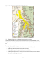


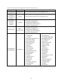
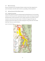


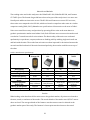
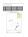
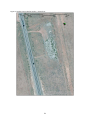

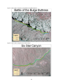

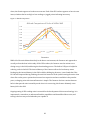


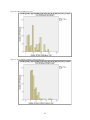
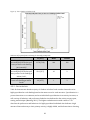
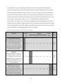

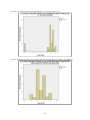
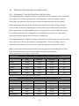


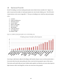


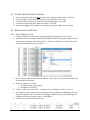


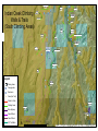


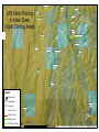


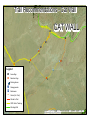

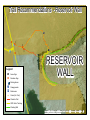

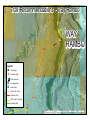


![ESCORT NON CROP LABEL REVISED [LABEL]](http://vs1.manualzilla.com/store/data/006415778_1-66433d966702e314c8c9a84af9177b1b-150x150.png)


![ESCORT NON CROP LABEL REVISED [LABEL]](http://vs1.manualzilla.com/store/data/006415776_1-80ca755f50b967b81acf8adc6ac6f7ff-150x150.png)